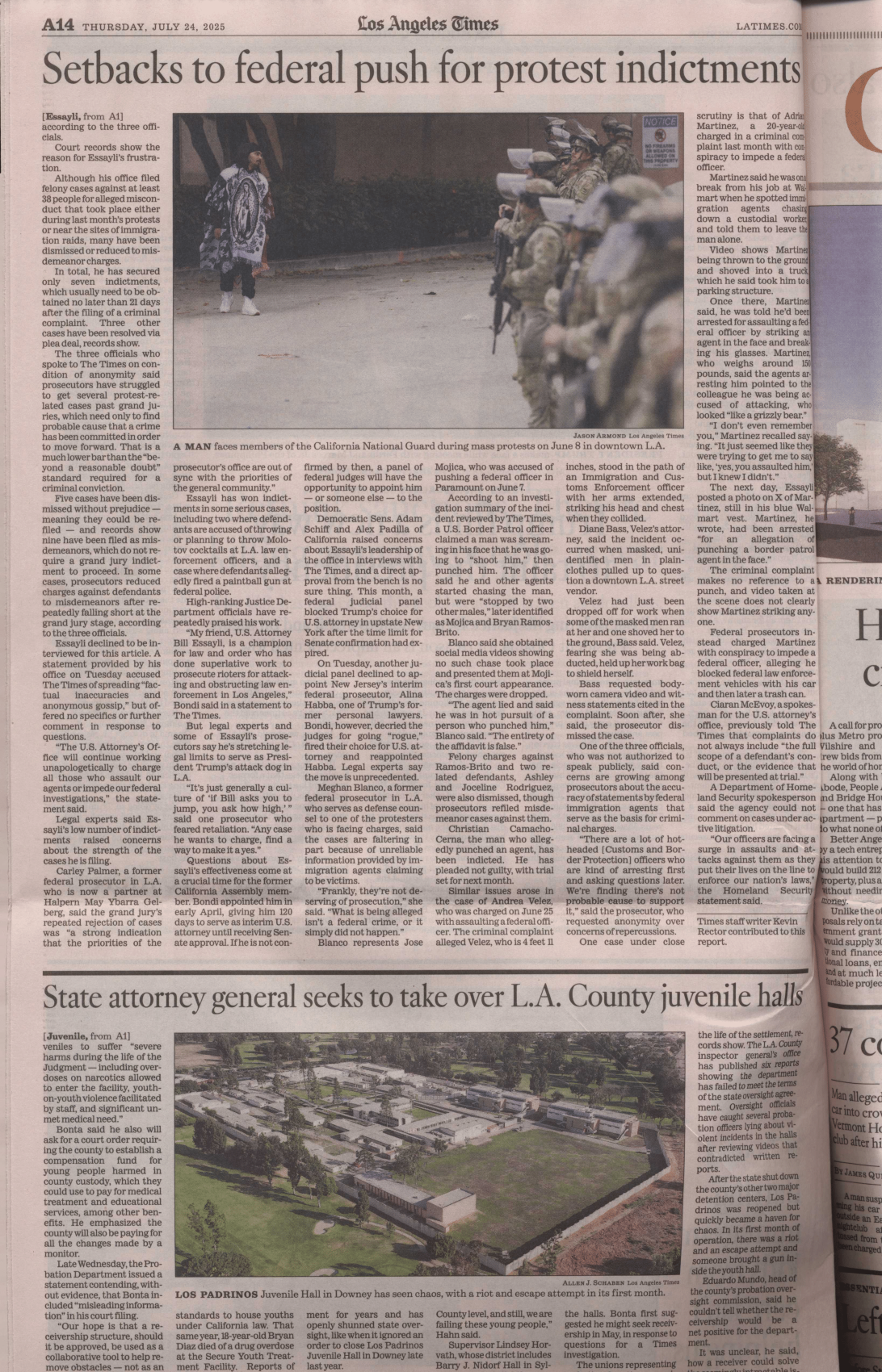
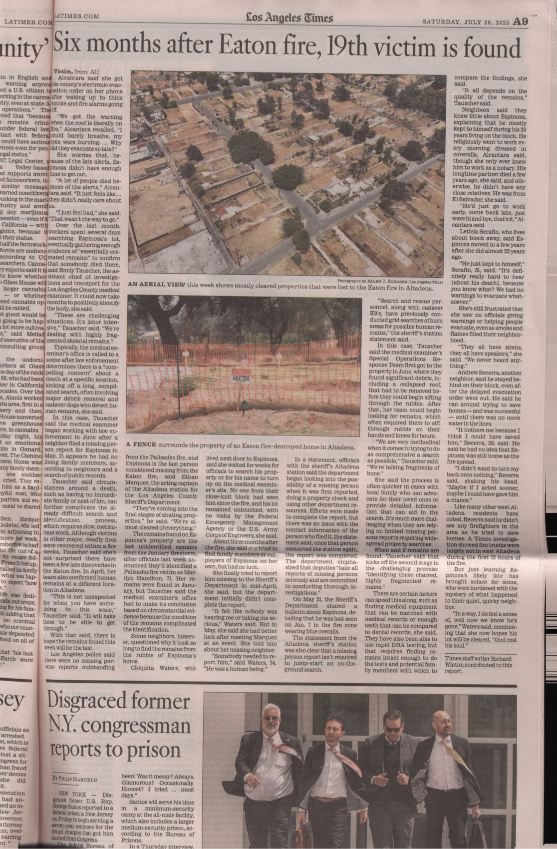
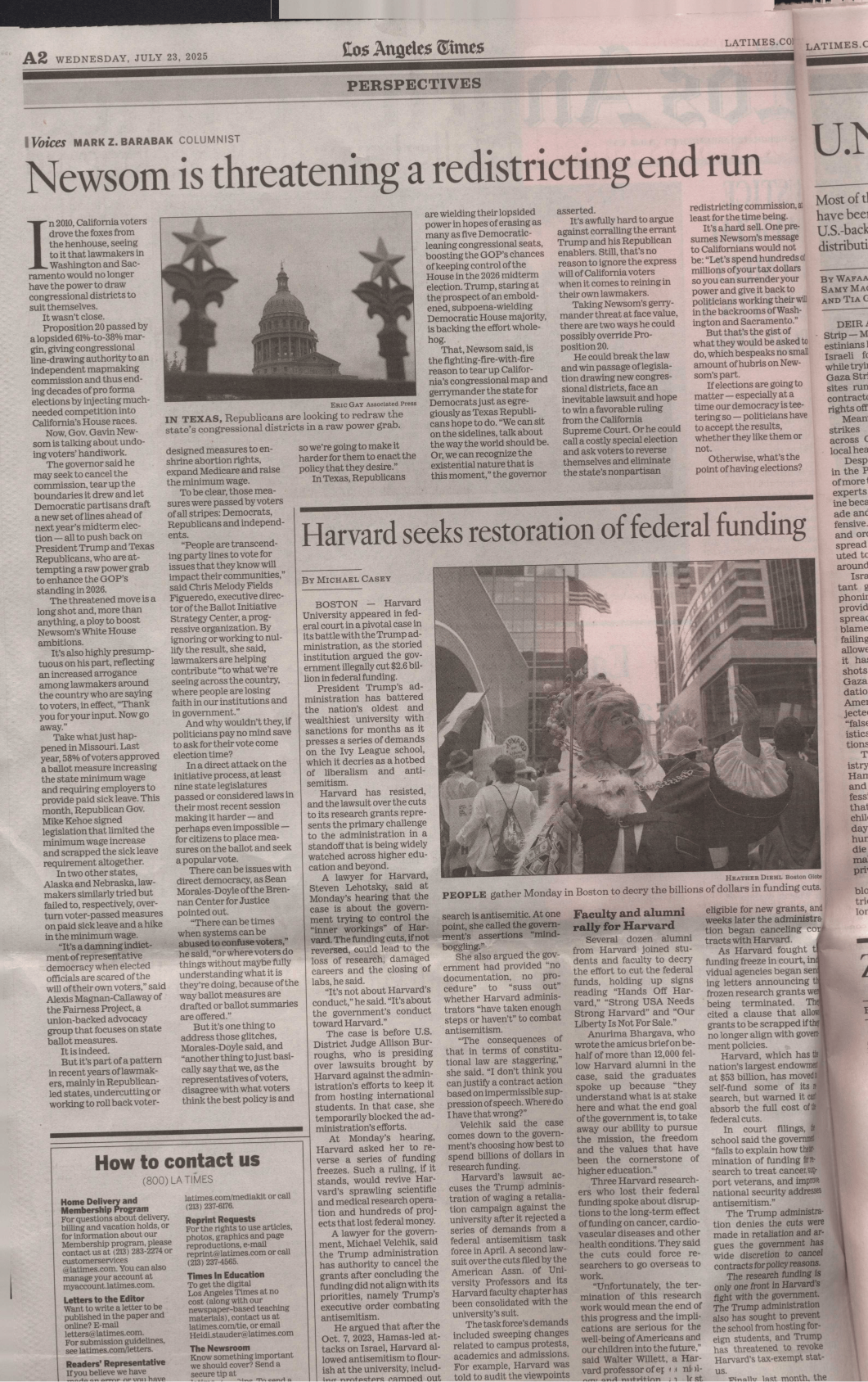
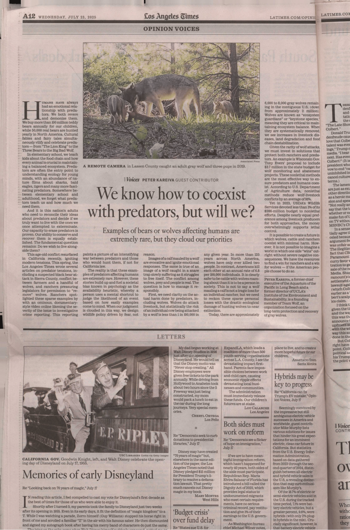
@Nasa FireReport
Written on November 20, 2025 November 20th, 2025 by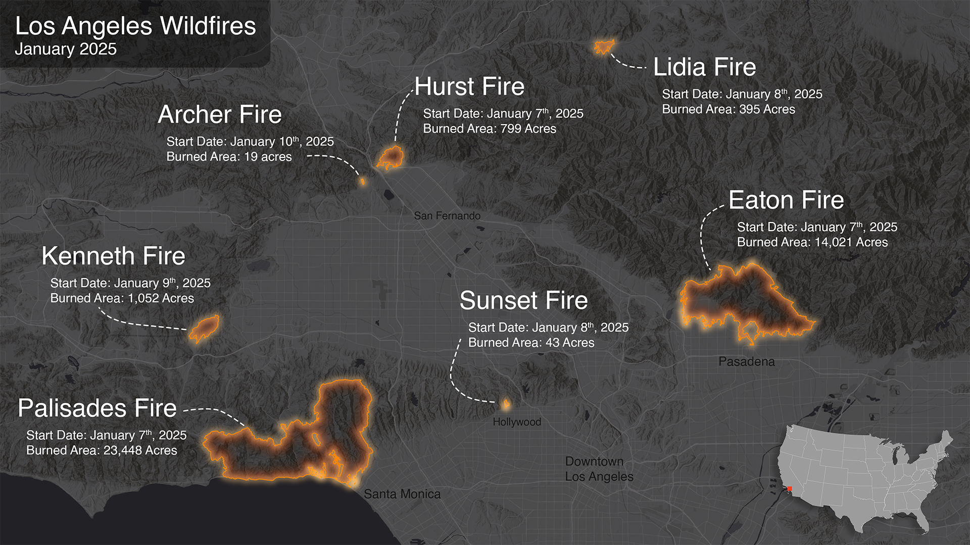
by
tags: 20 November 2025hotlinks @NASA-JPL
USGS WaTERDASHBOARD @usgs DSCOVR: EPIC _ Gallery : West Coast Wildfires NASA - LANCE - FiRMS Global Fire Map, Live MAps with KML - downloads @nasa it looks like cal fire uses ViiRS or another one of our climate sats @noaa for this map!
WeFunkRadio + latest LordSear && Show 1270 seem good @blackgirlscode

January 8th 2025 Formaldehyde (HCHO)
Time Averaged Map of HCHO column amount daily 0.1 deg. [OMI OMHCHOd v003] molecules/cm^2 over 2025-01-01 - 2025-01-31
ime Averaged Map of Aerosol Single Scattering Albedo 483.5 nm daily 0.25 deg. [OMI OMAEROe v003] over 2025-01-01 - 2025-01-31
1 # HOLE_TO_ANOTHER_UNiVERSE##############################
@BlackGirLSCode Who is Brandy?########
1 # HOLE_TO_ANOTHER_UNiVERSE#####@NASA-JPL######hiCORAL###
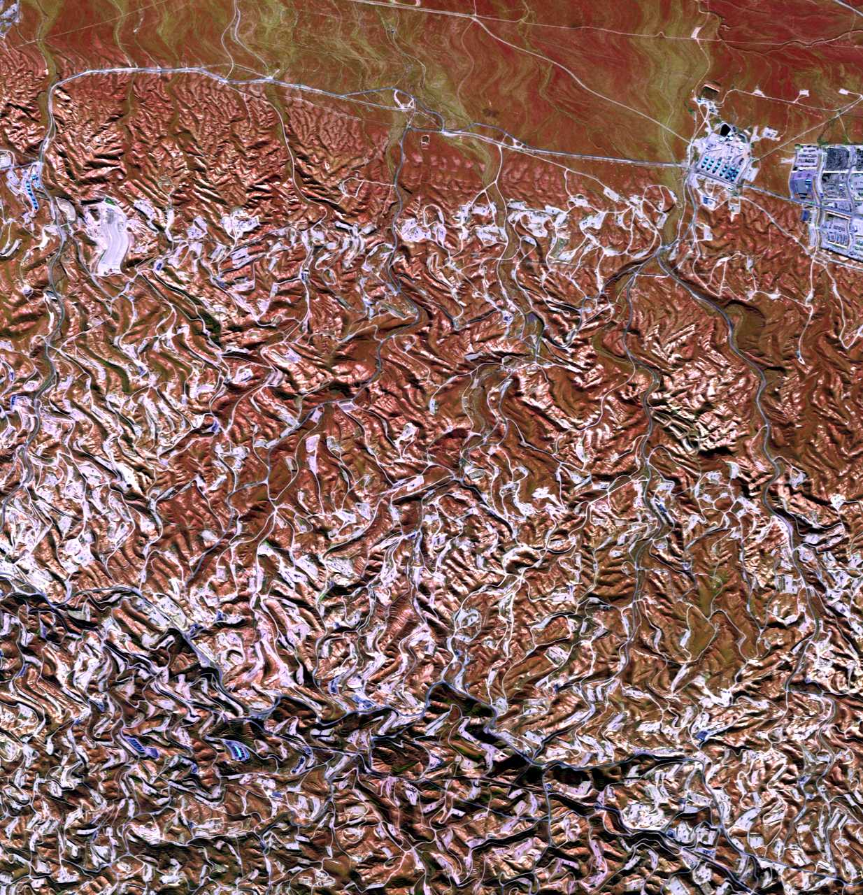
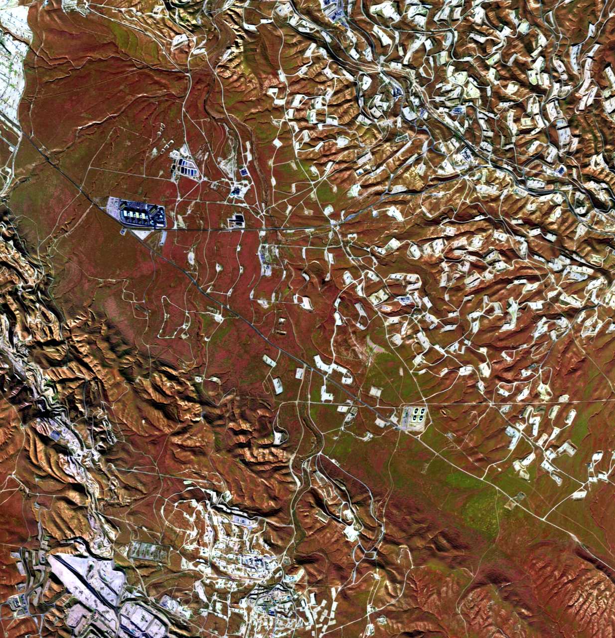
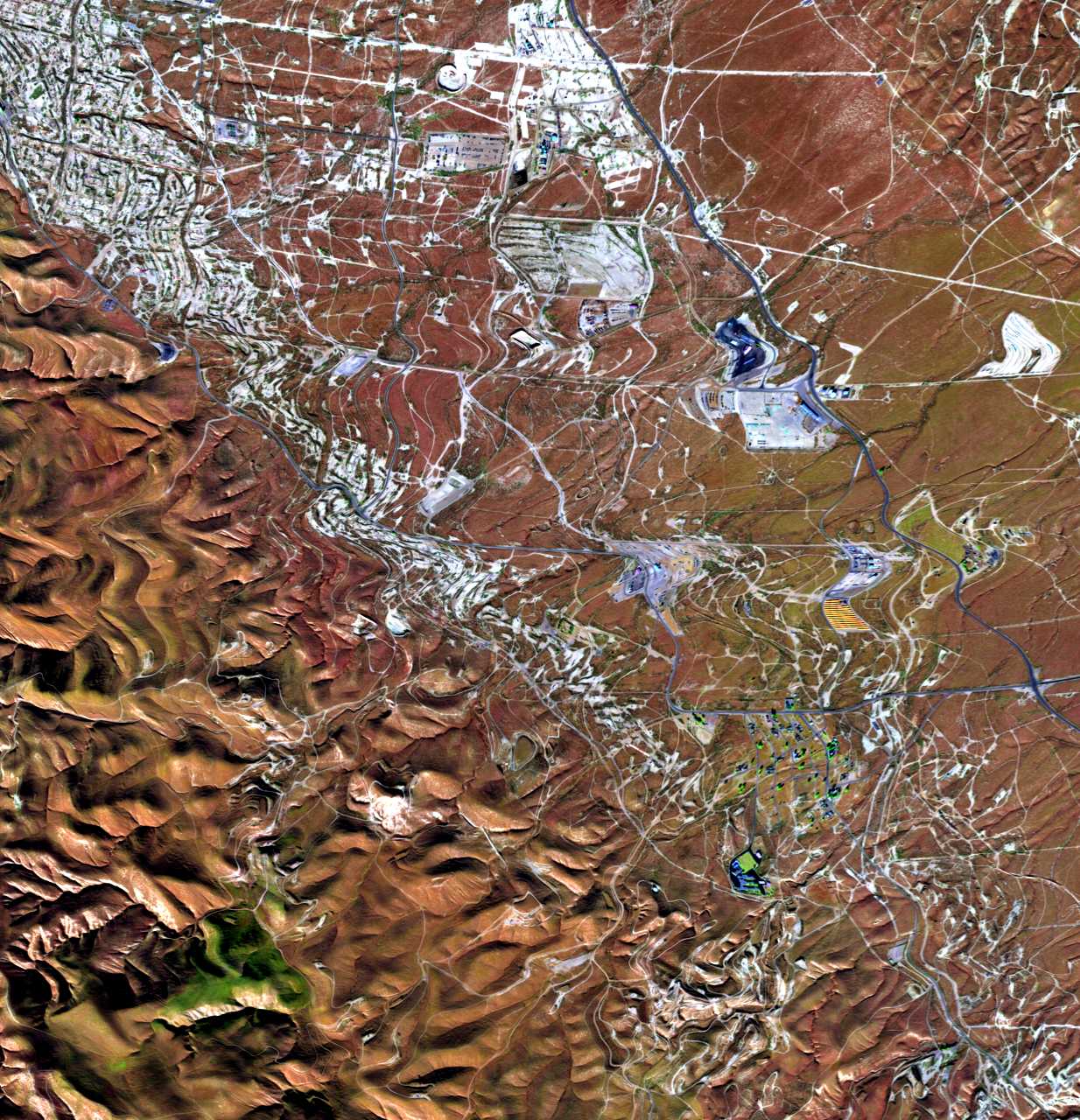
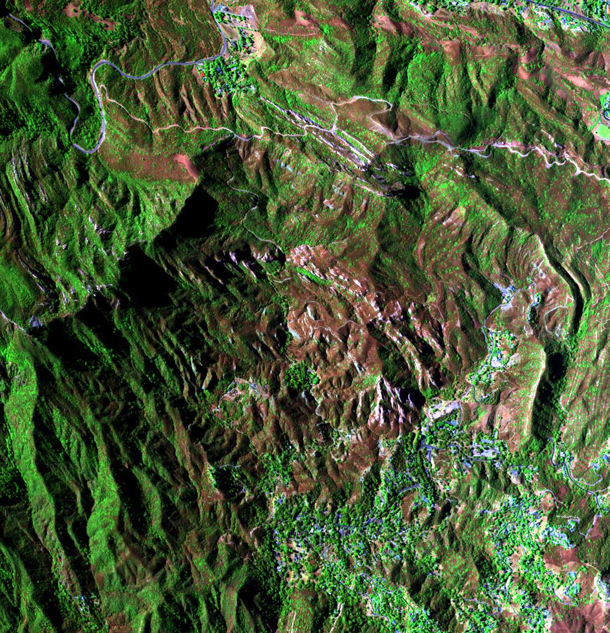
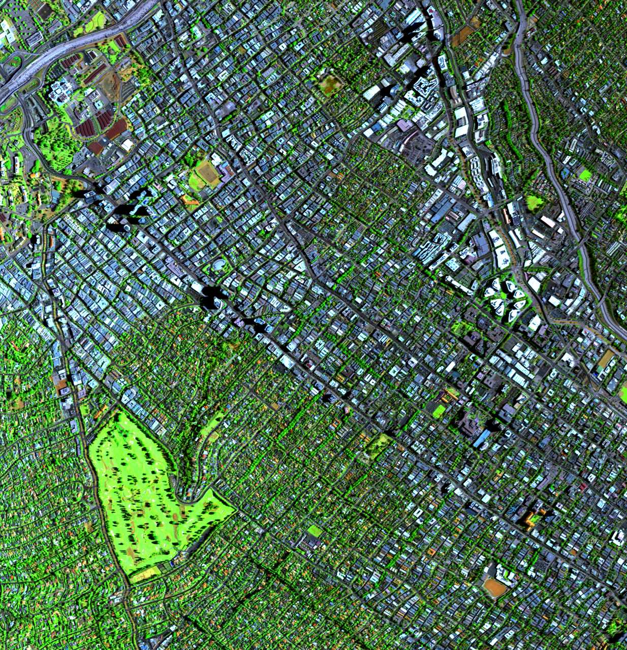
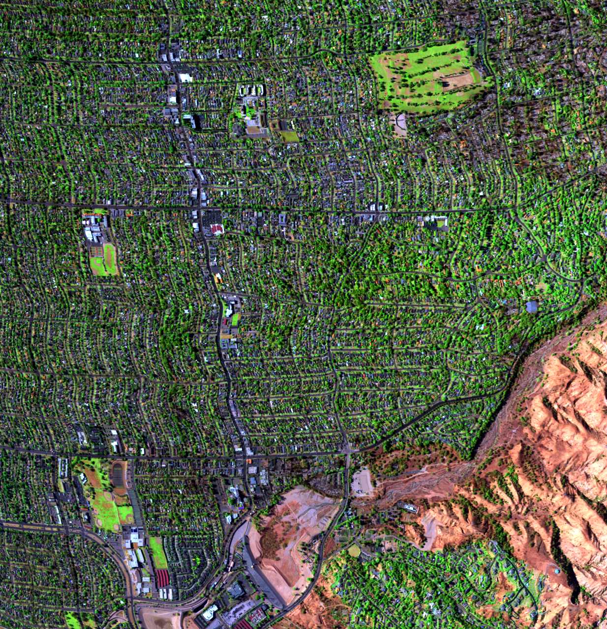
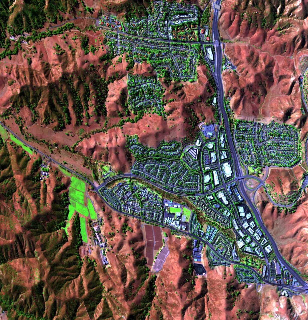
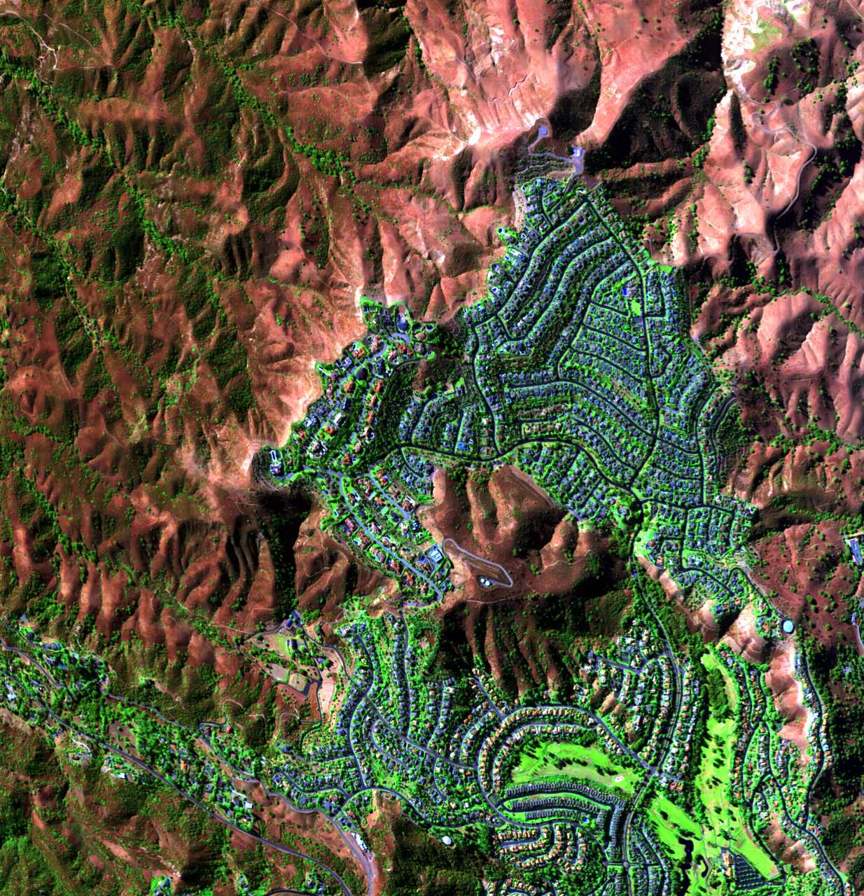
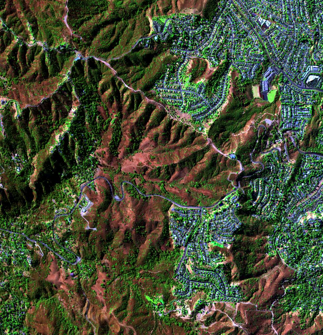
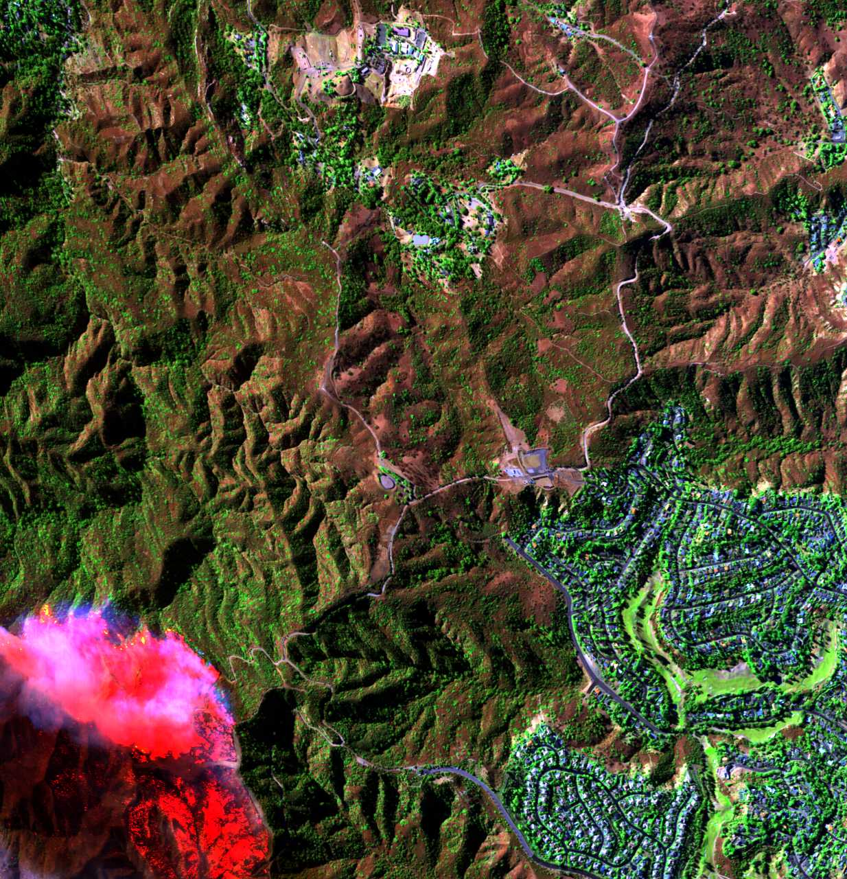
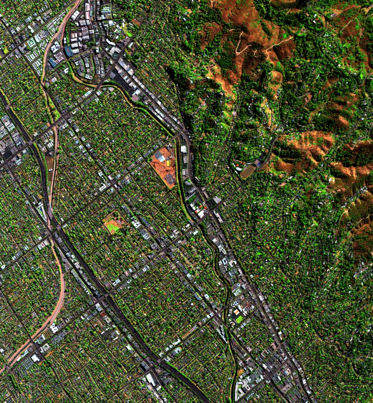
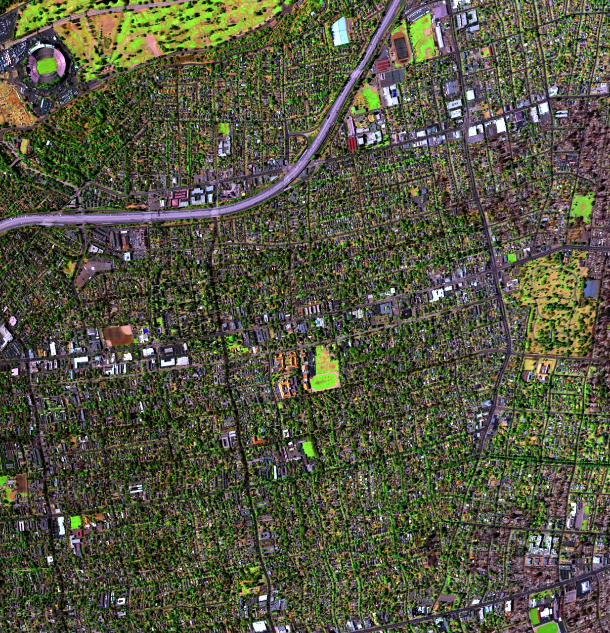
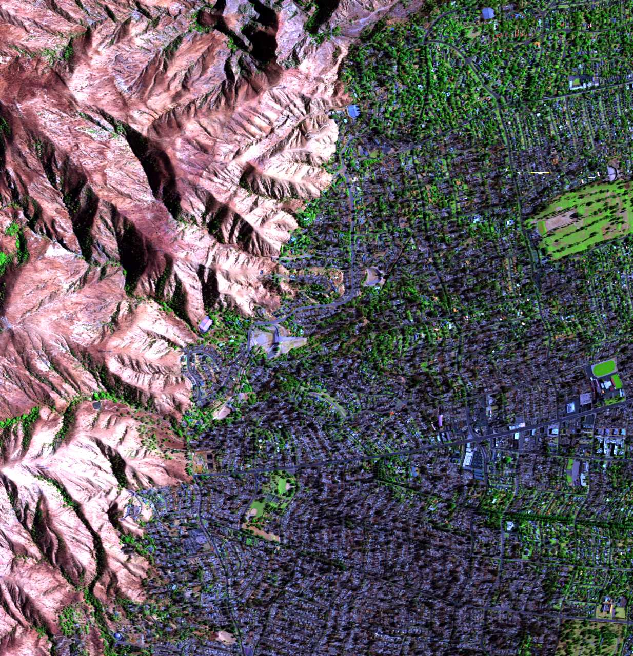
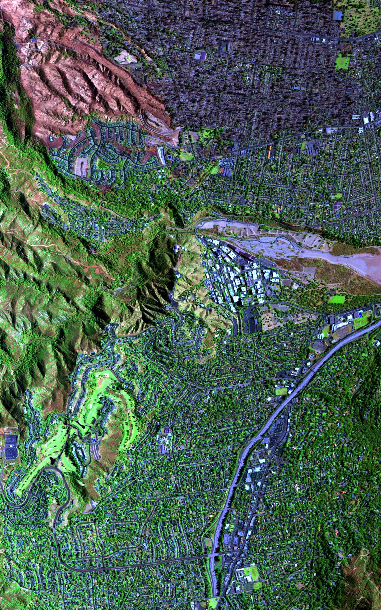
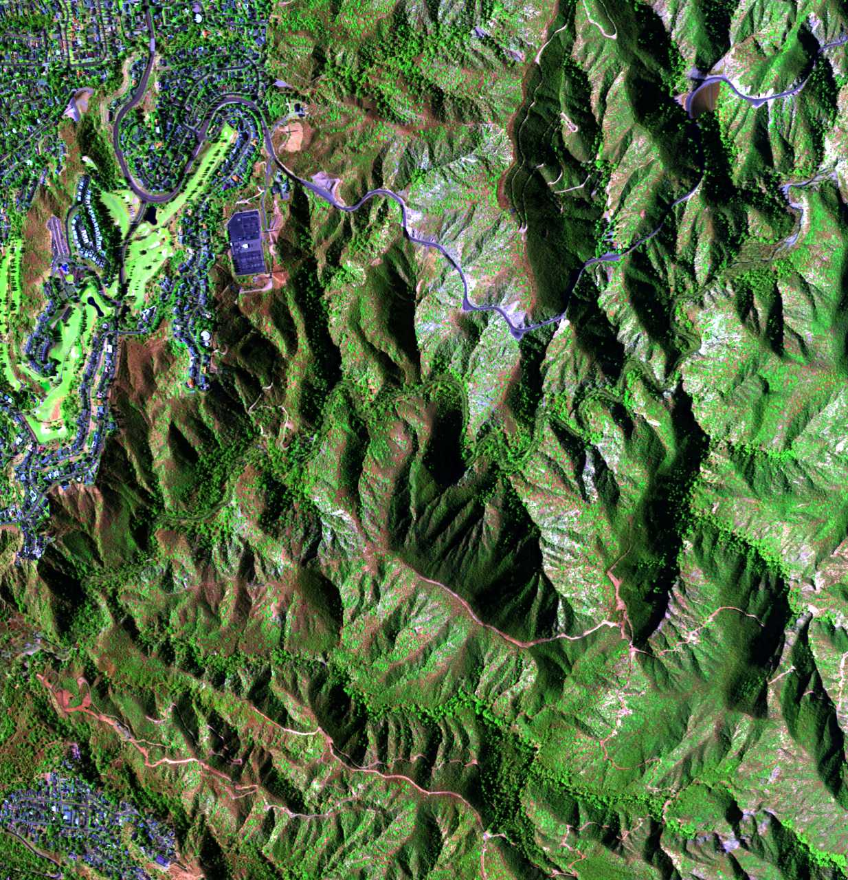
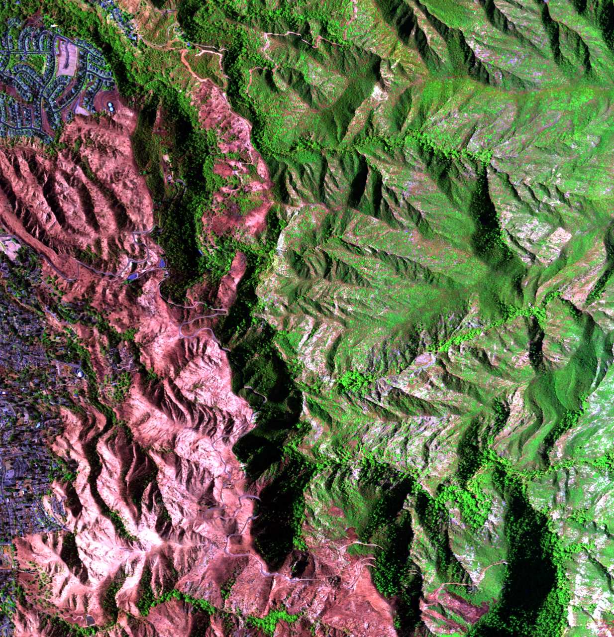
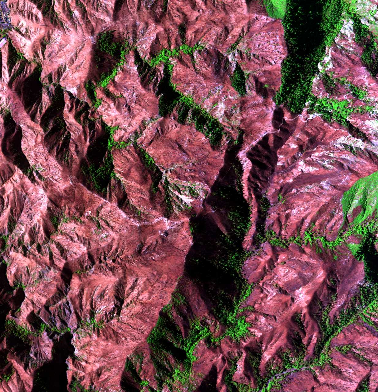
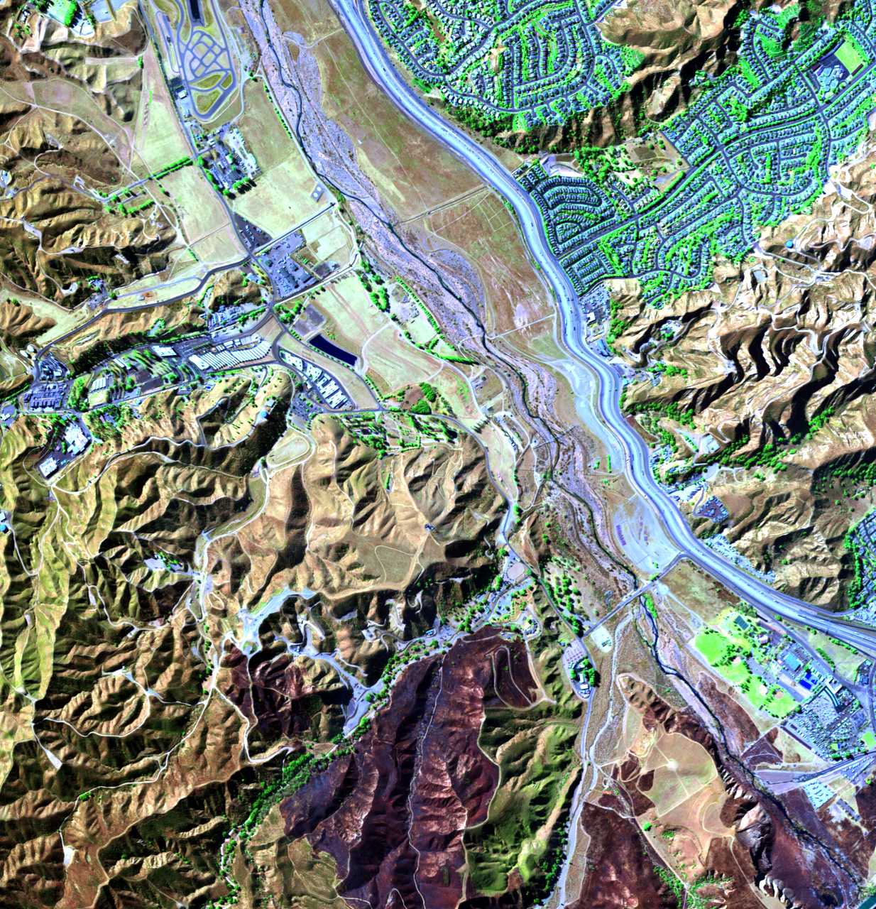
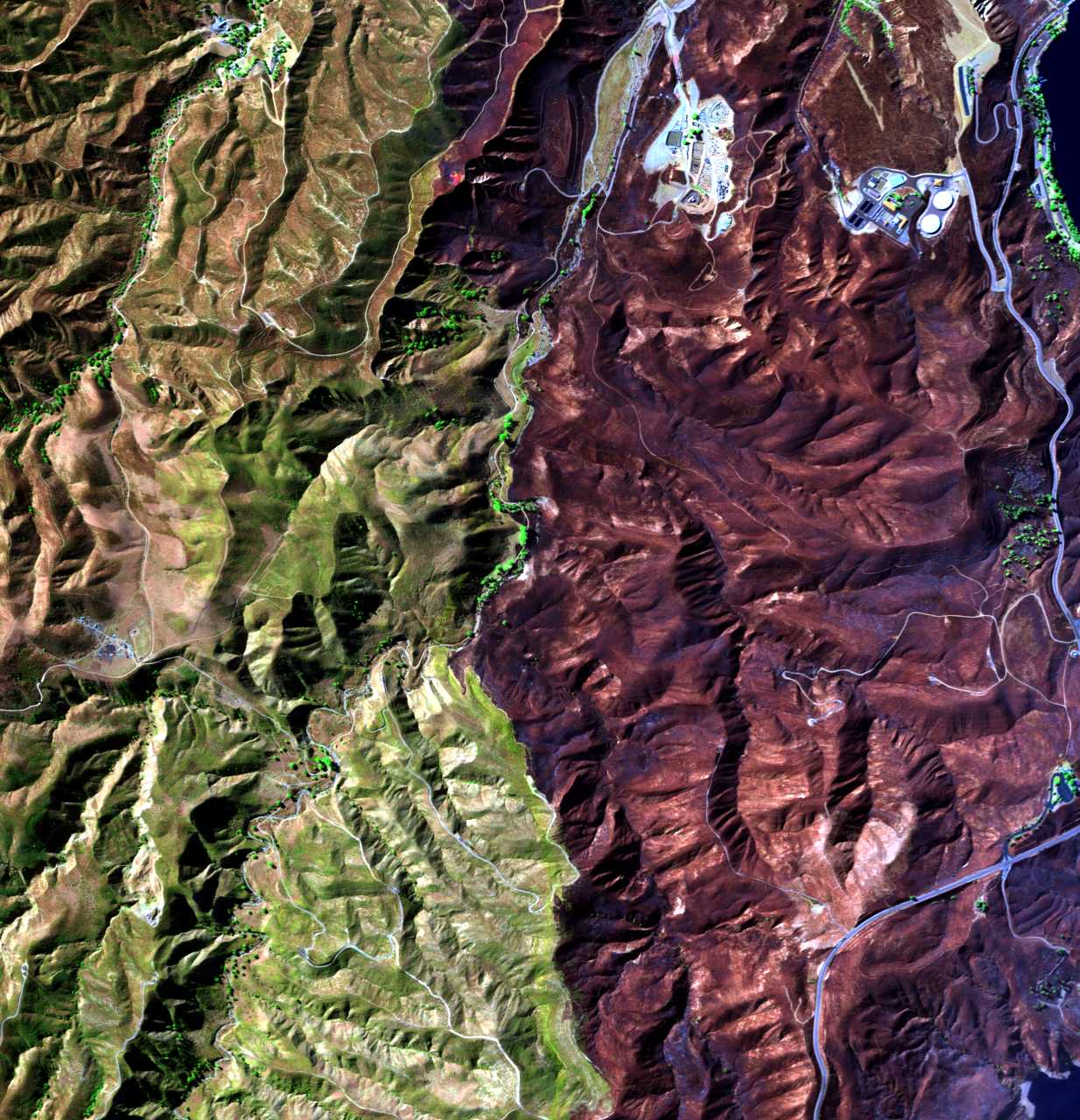
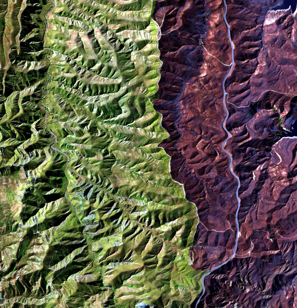
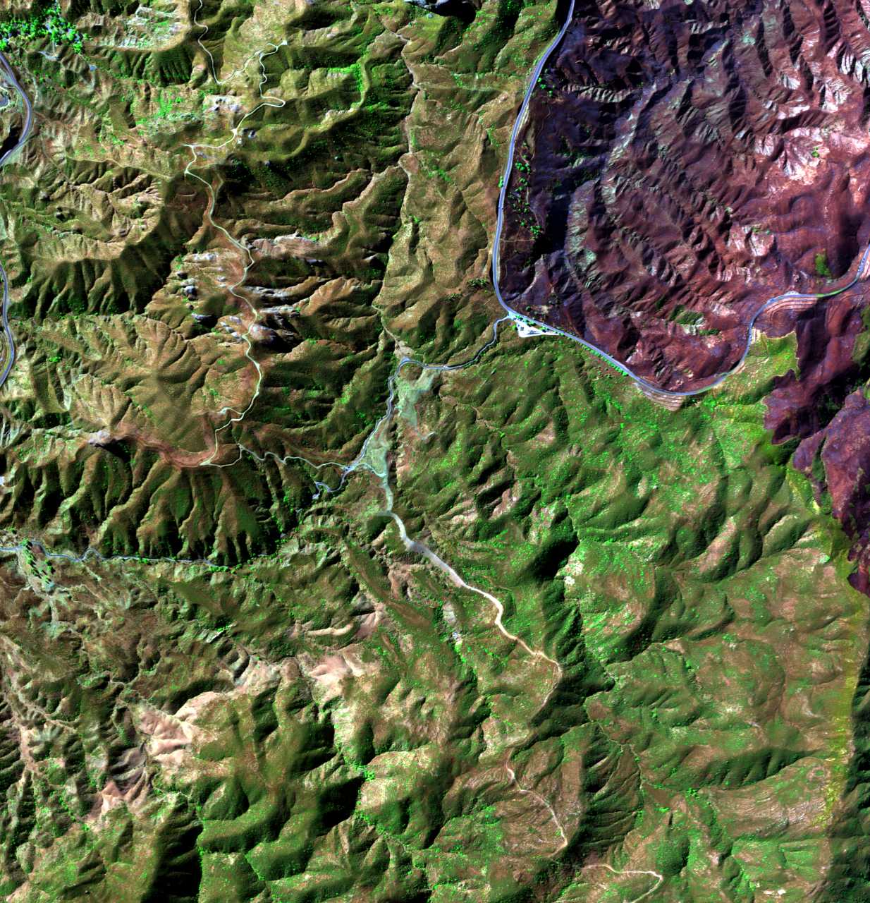
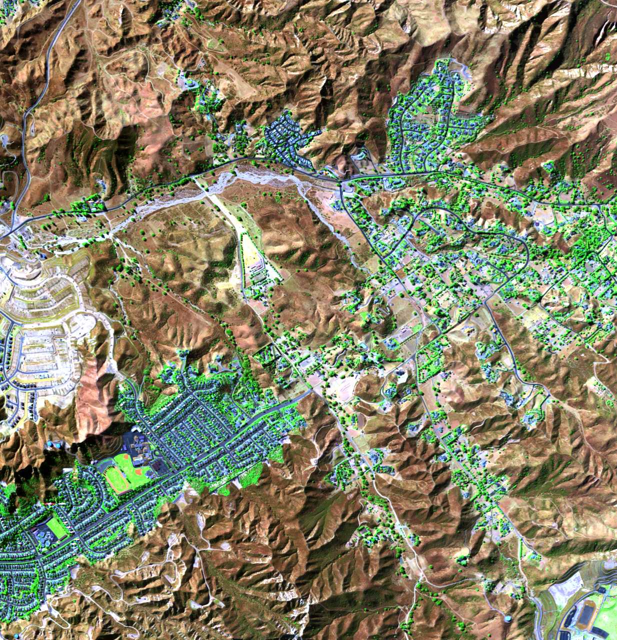
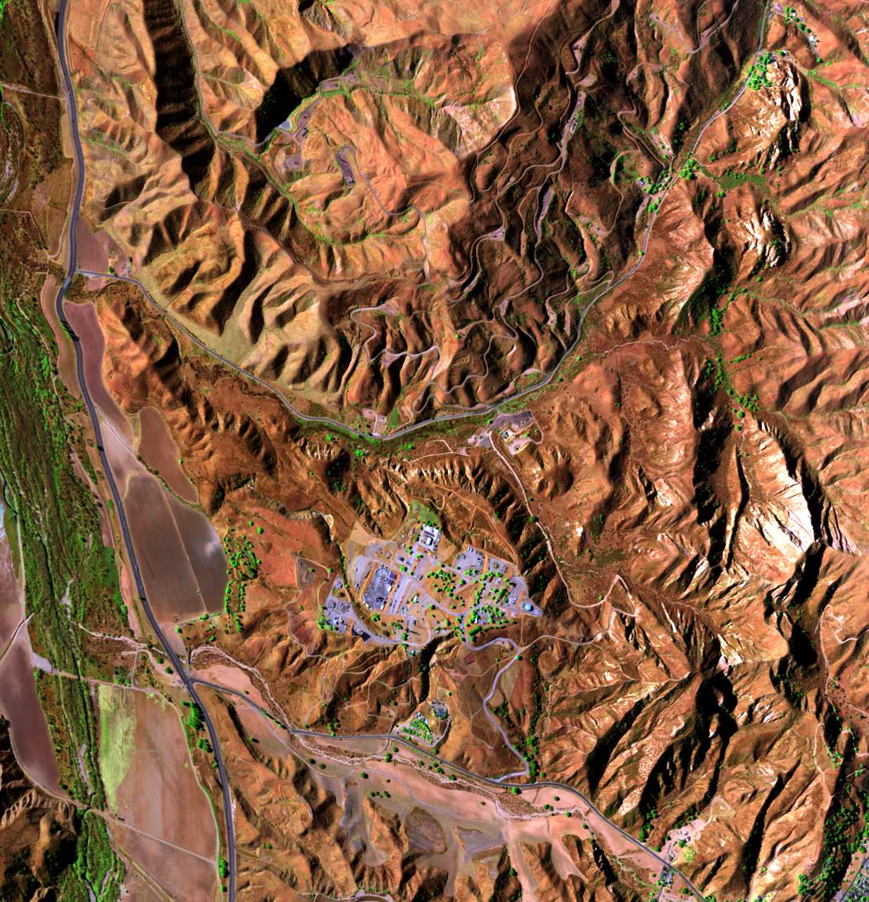
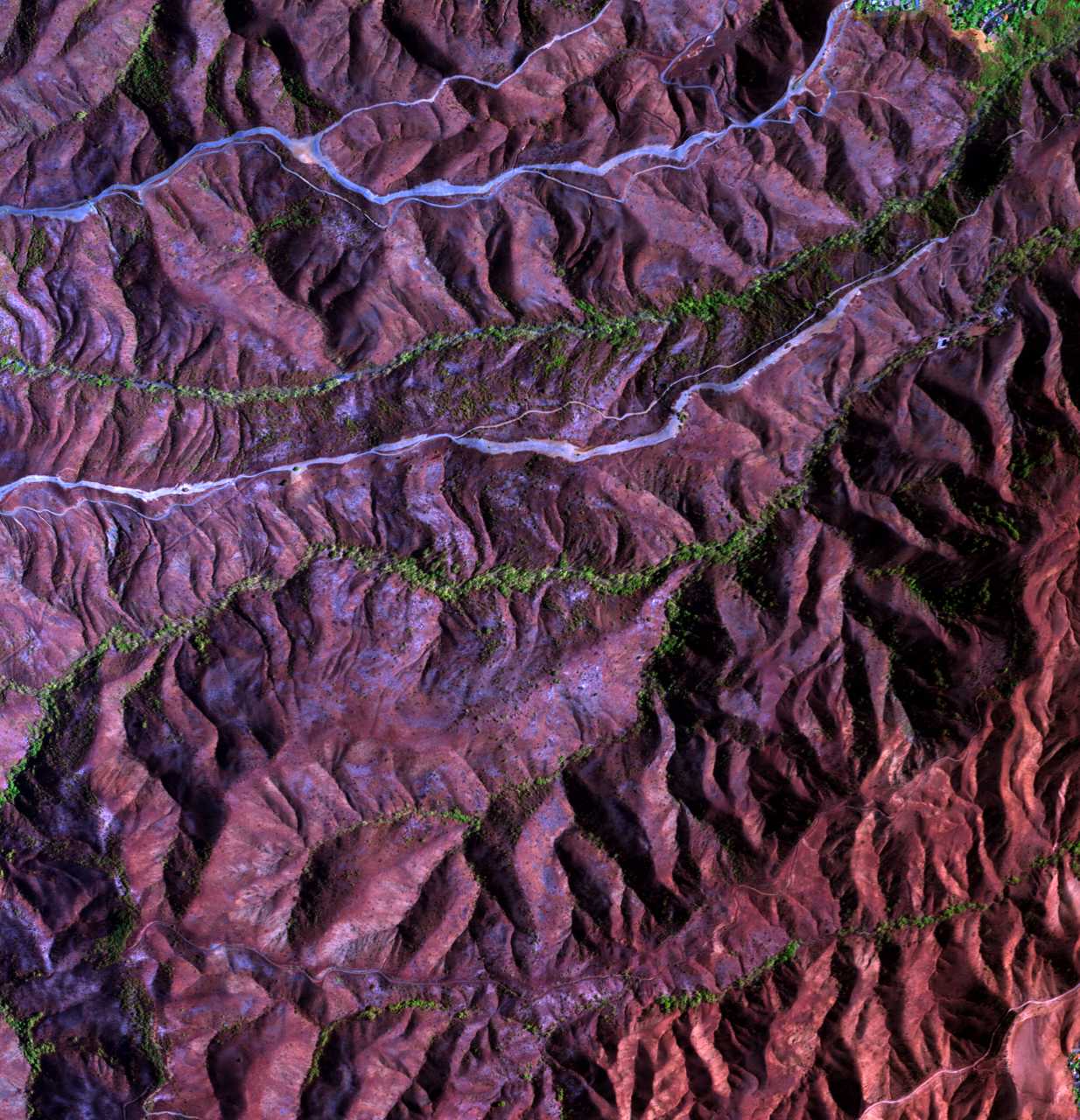
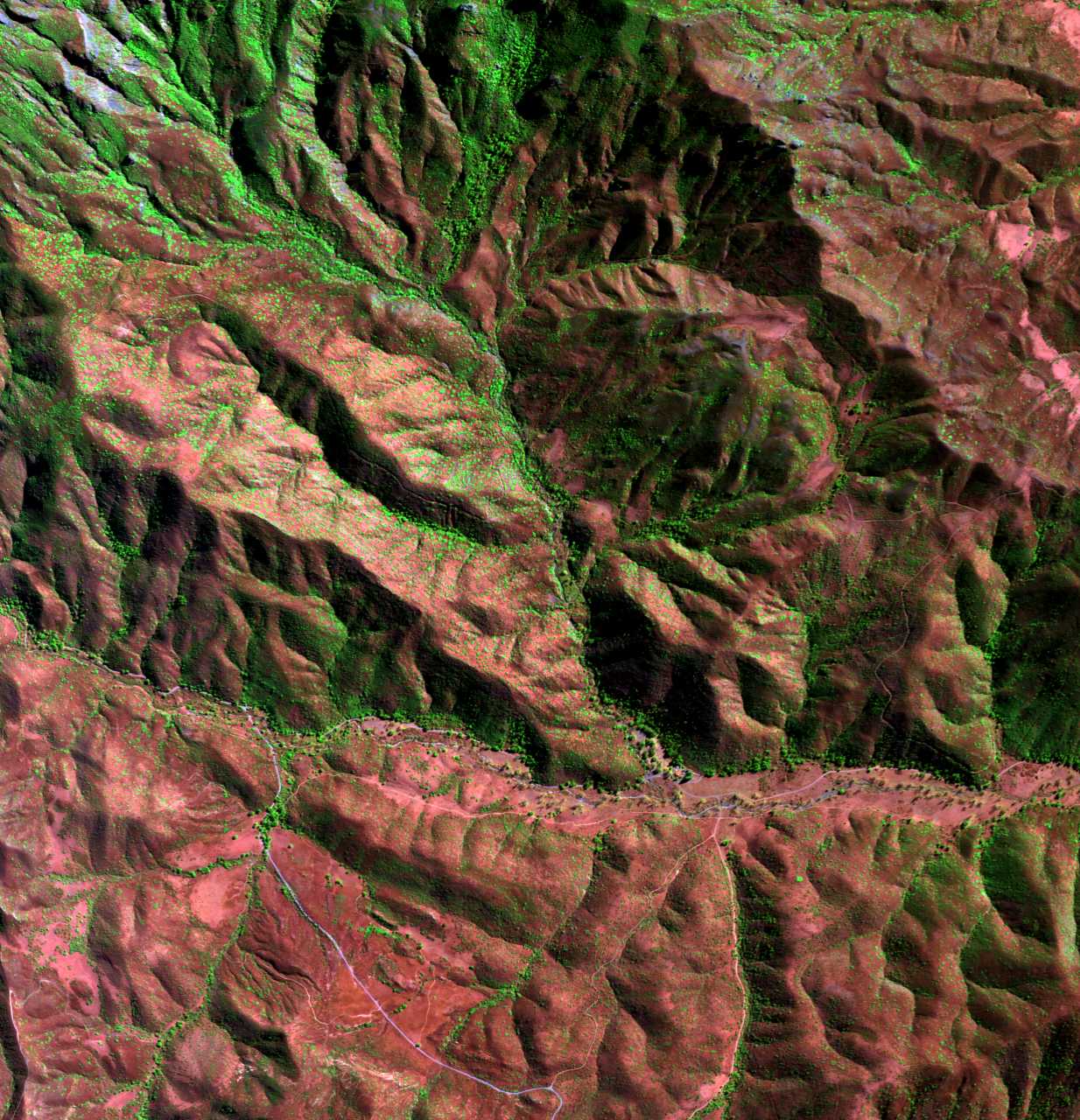
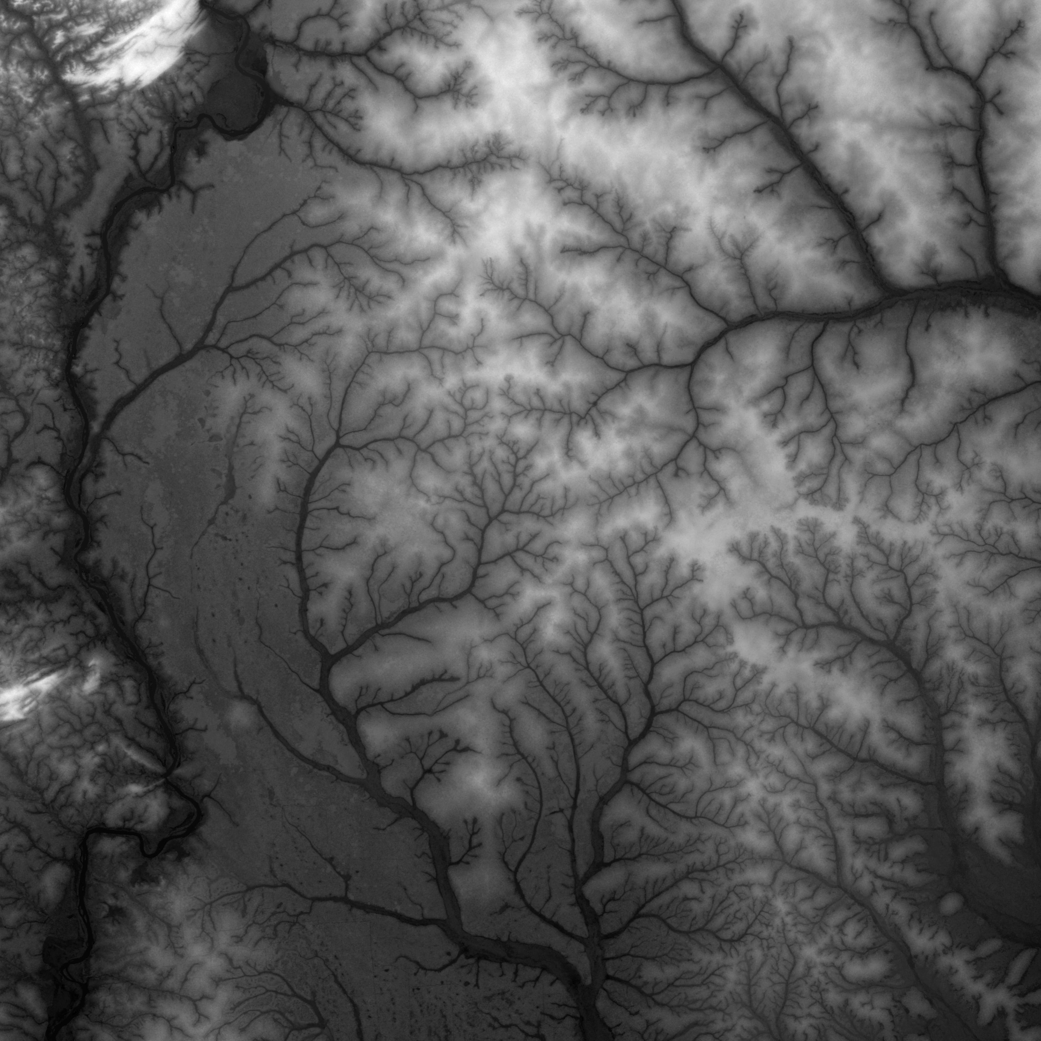
2 # ### How Wildfire Looked Across @CityOfLosAngeles #####
3 # @StateOfCalifornia #`BrandyNorwood @BlackGirlsCode `##Upclose / Scene @vsco @emit-sds @NASA-DEVELOP MALiBU @CityOfLosangeles StateOfcalifornia
2 # ### How Wildfire looks across the continent ##############
3 # ANOTHER########`BrandyNorwood @BlackGirlsCode `Production#+ @cityoflosangeles DEC 23-to-2025 JAN 14 FireActiity @stateofcalifornia .gif DOWNLOAD @nasa-jpl @emit-sds @TheSpaceDevs @BlueOrigin @r-spacex @NOAAgov
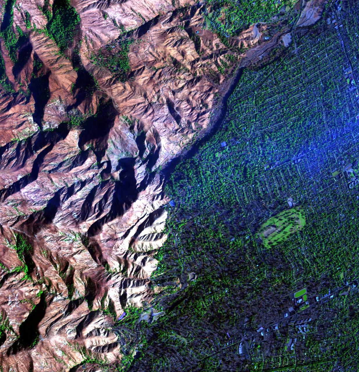
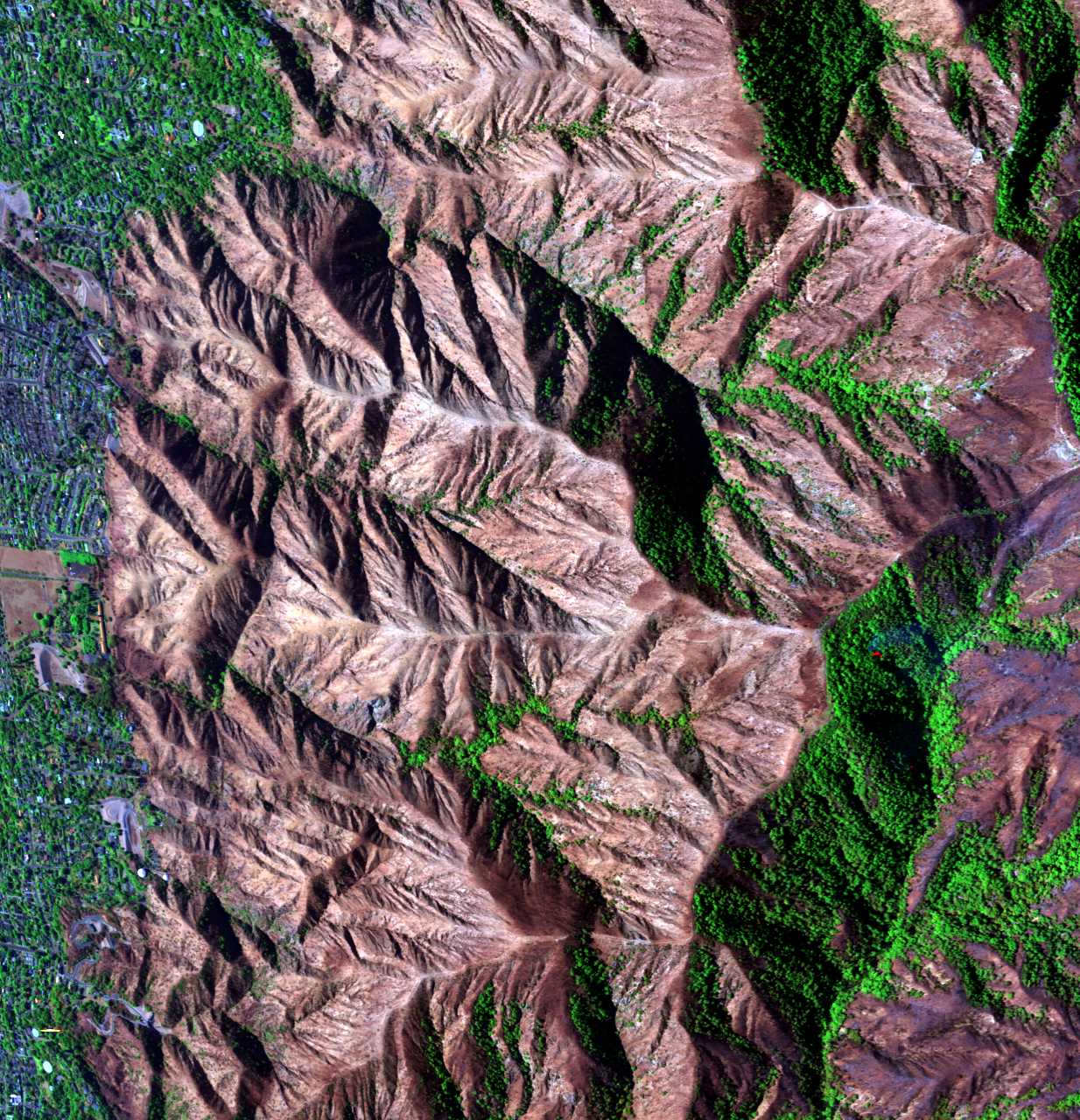
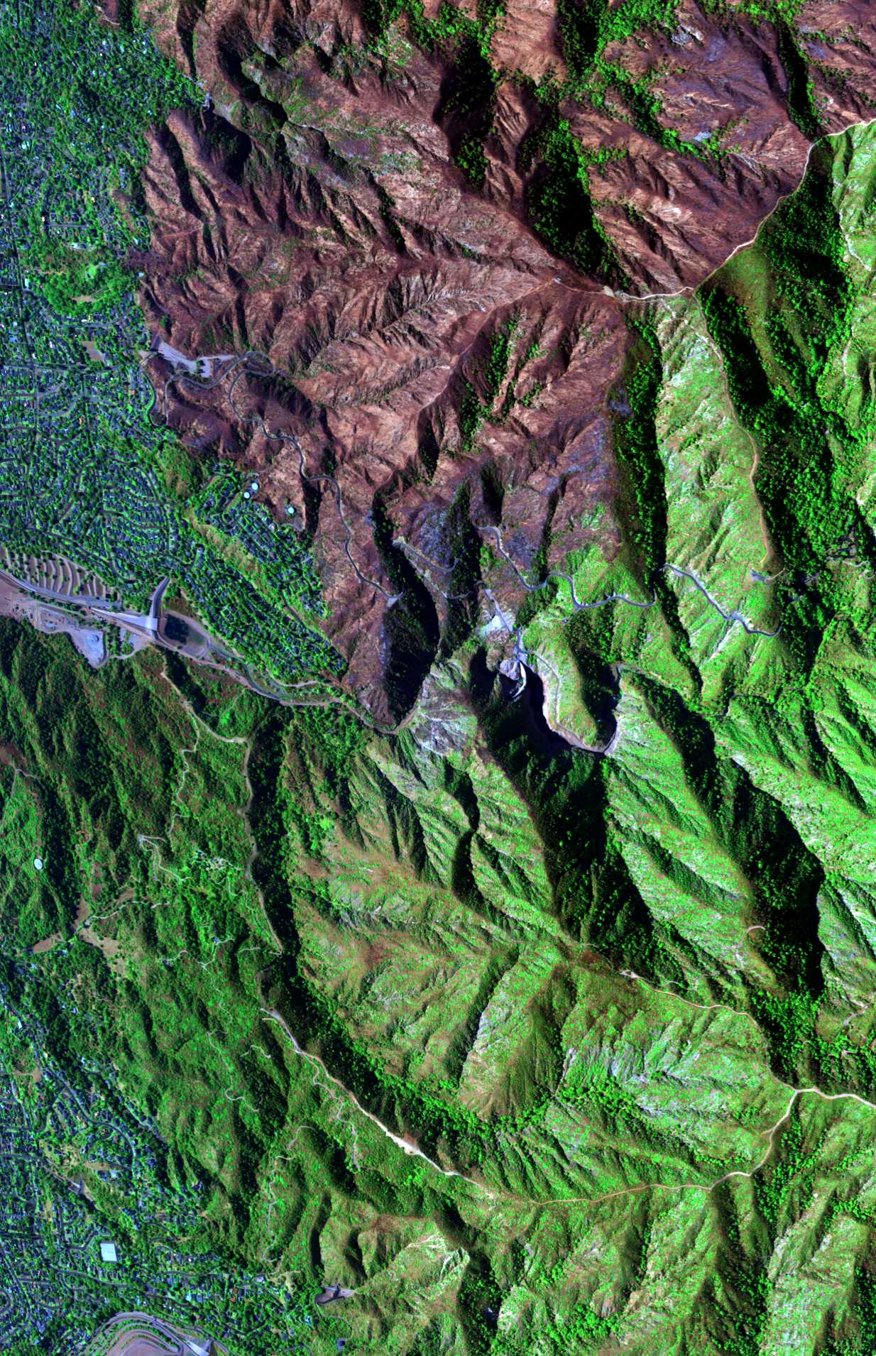
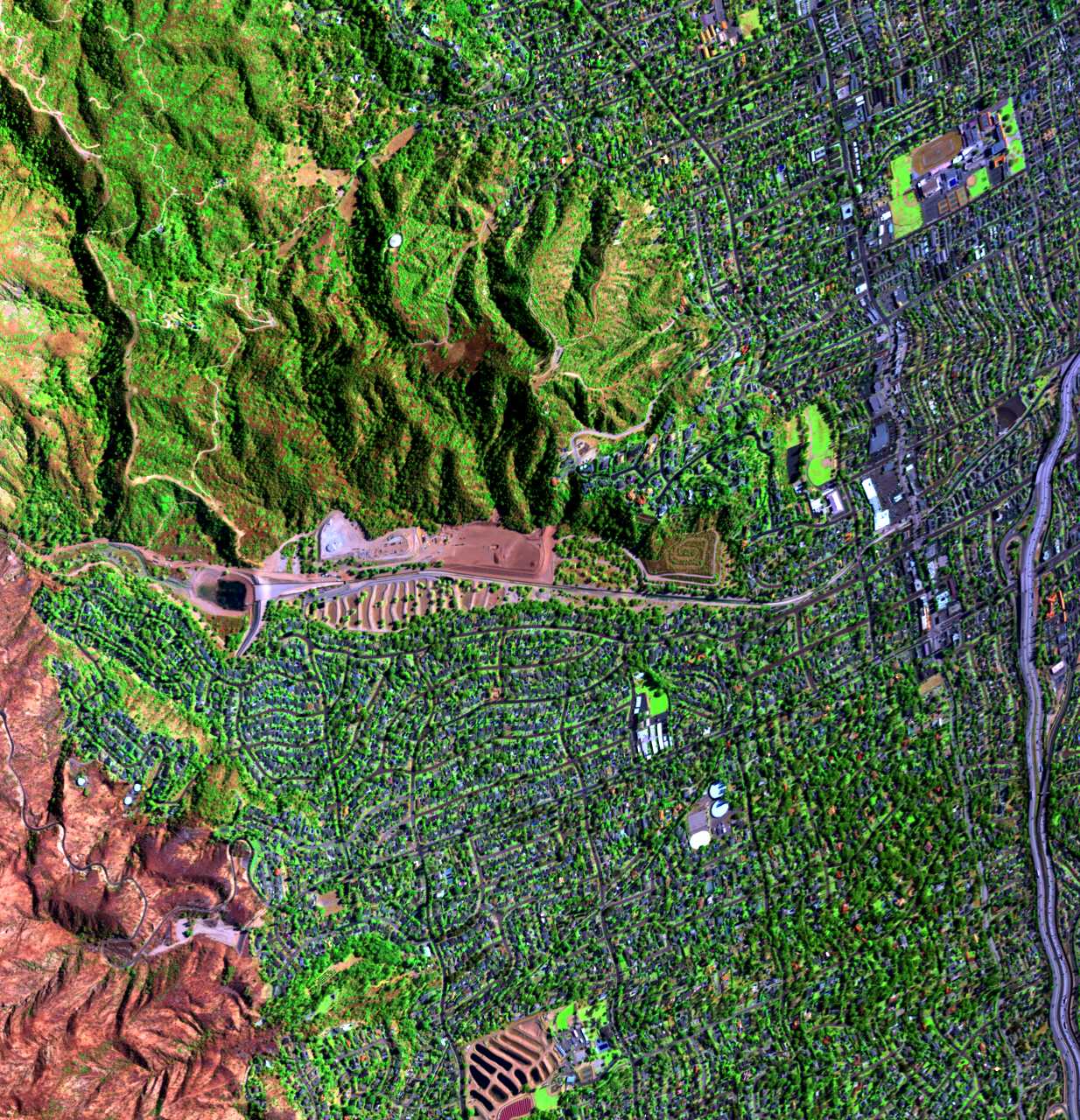
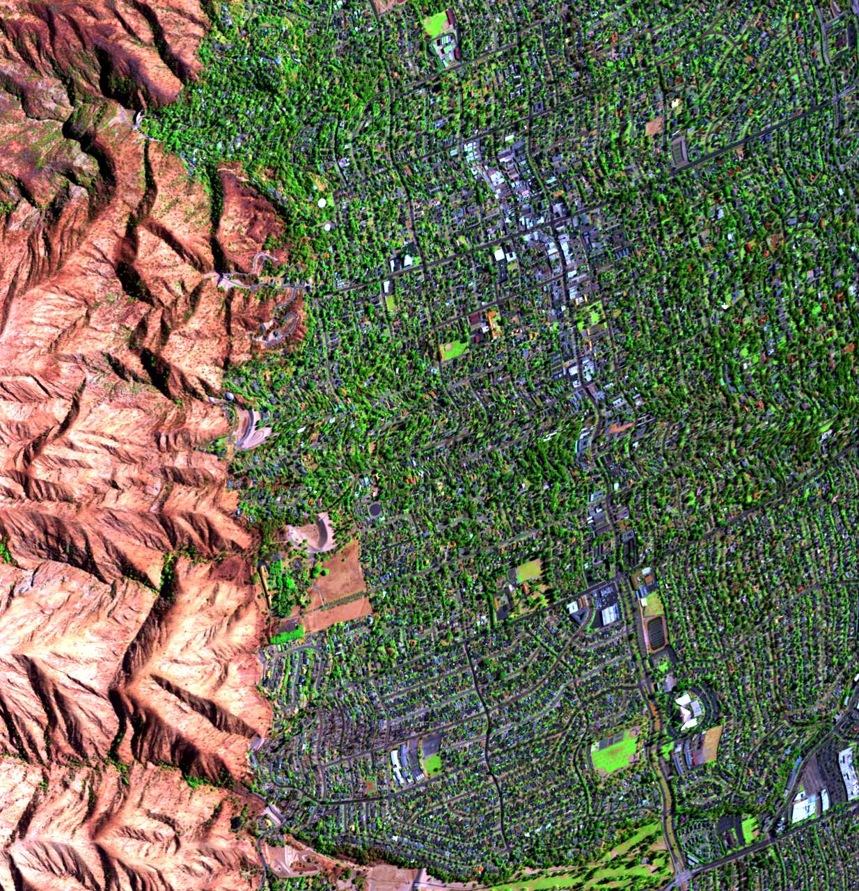
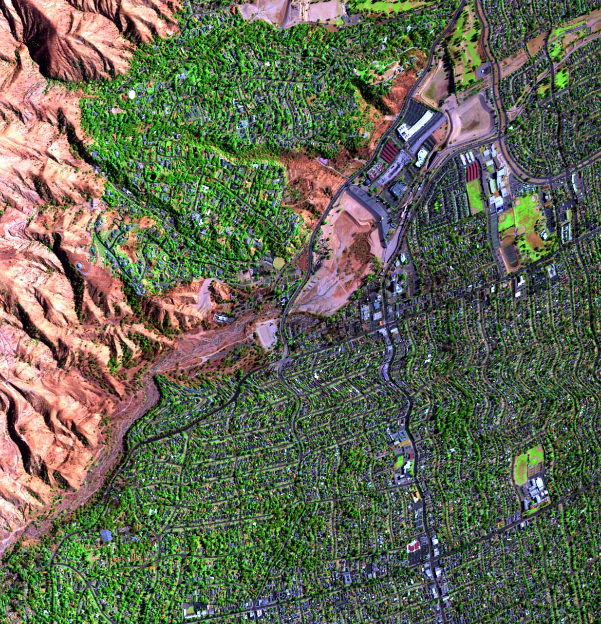
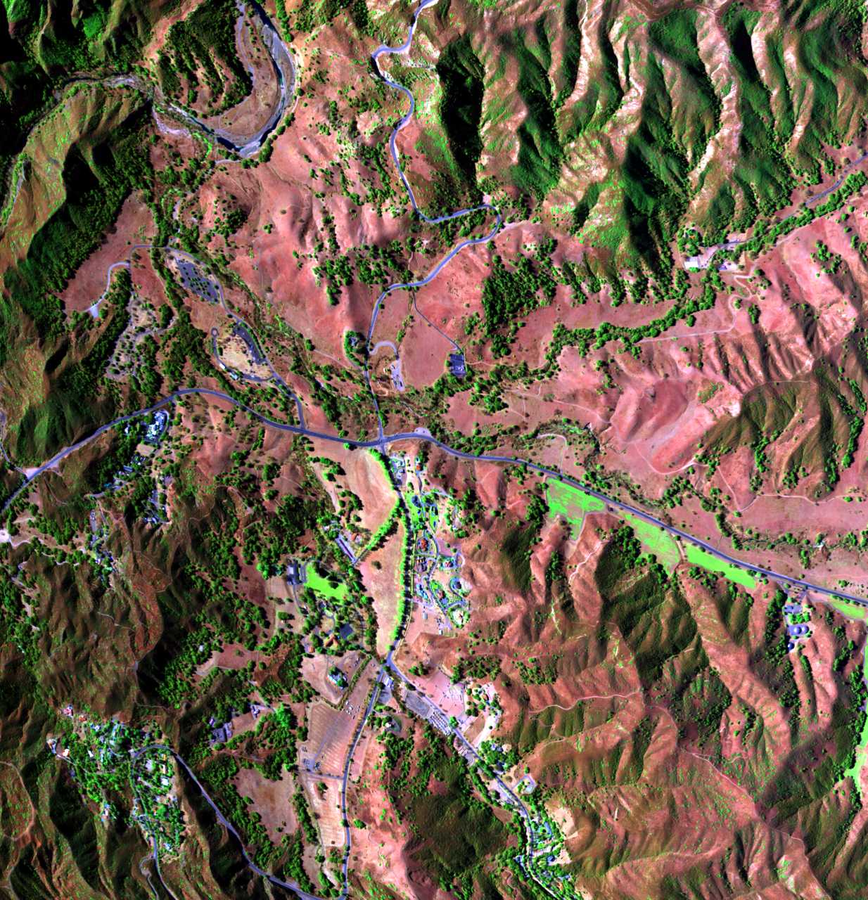
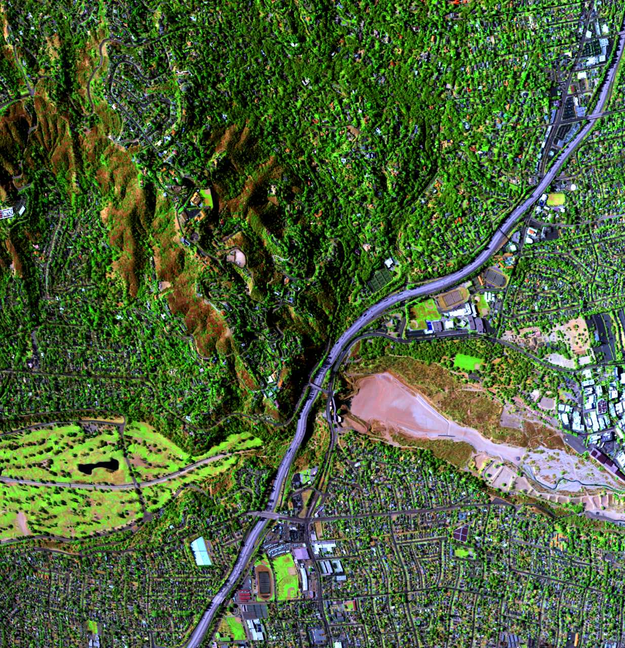
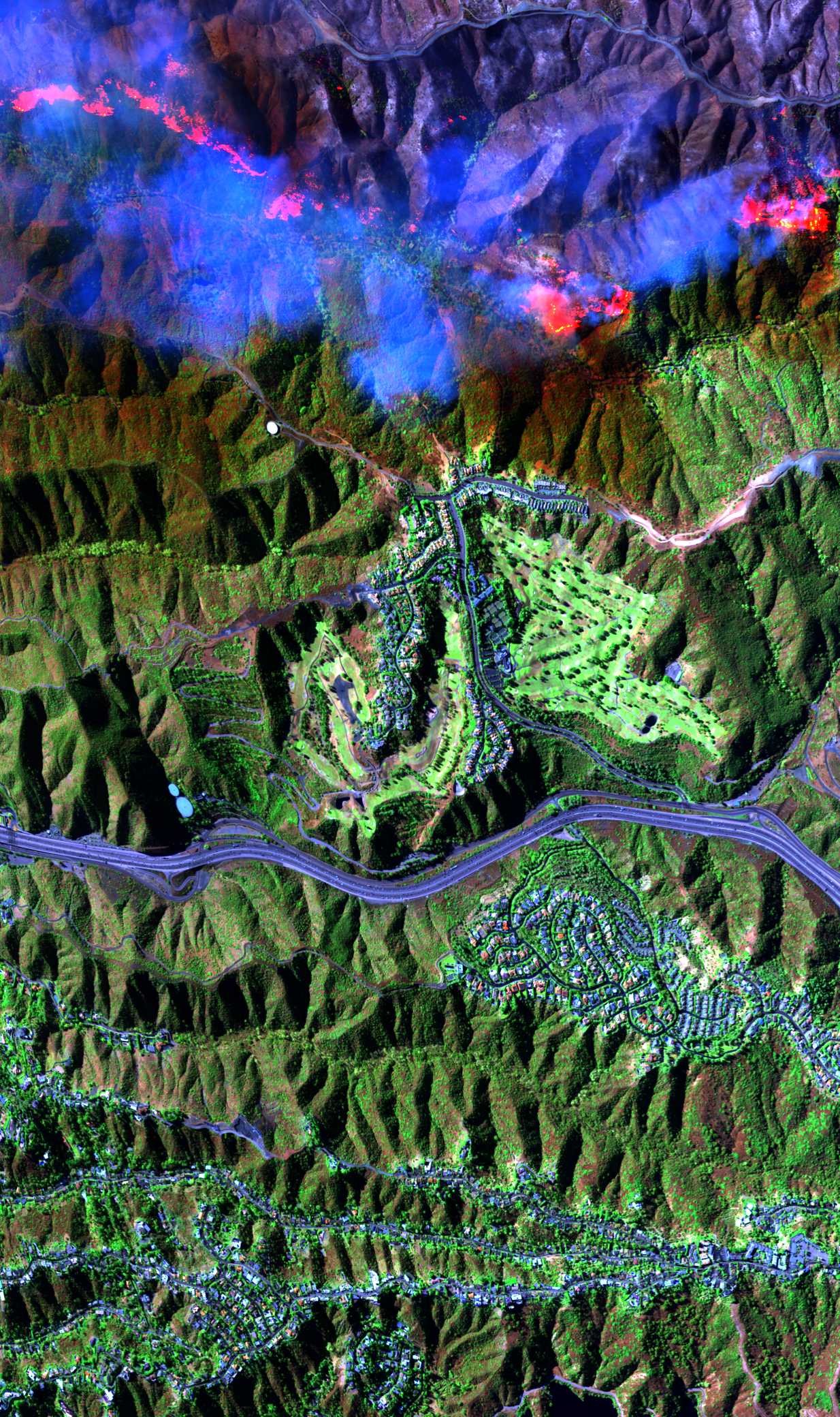
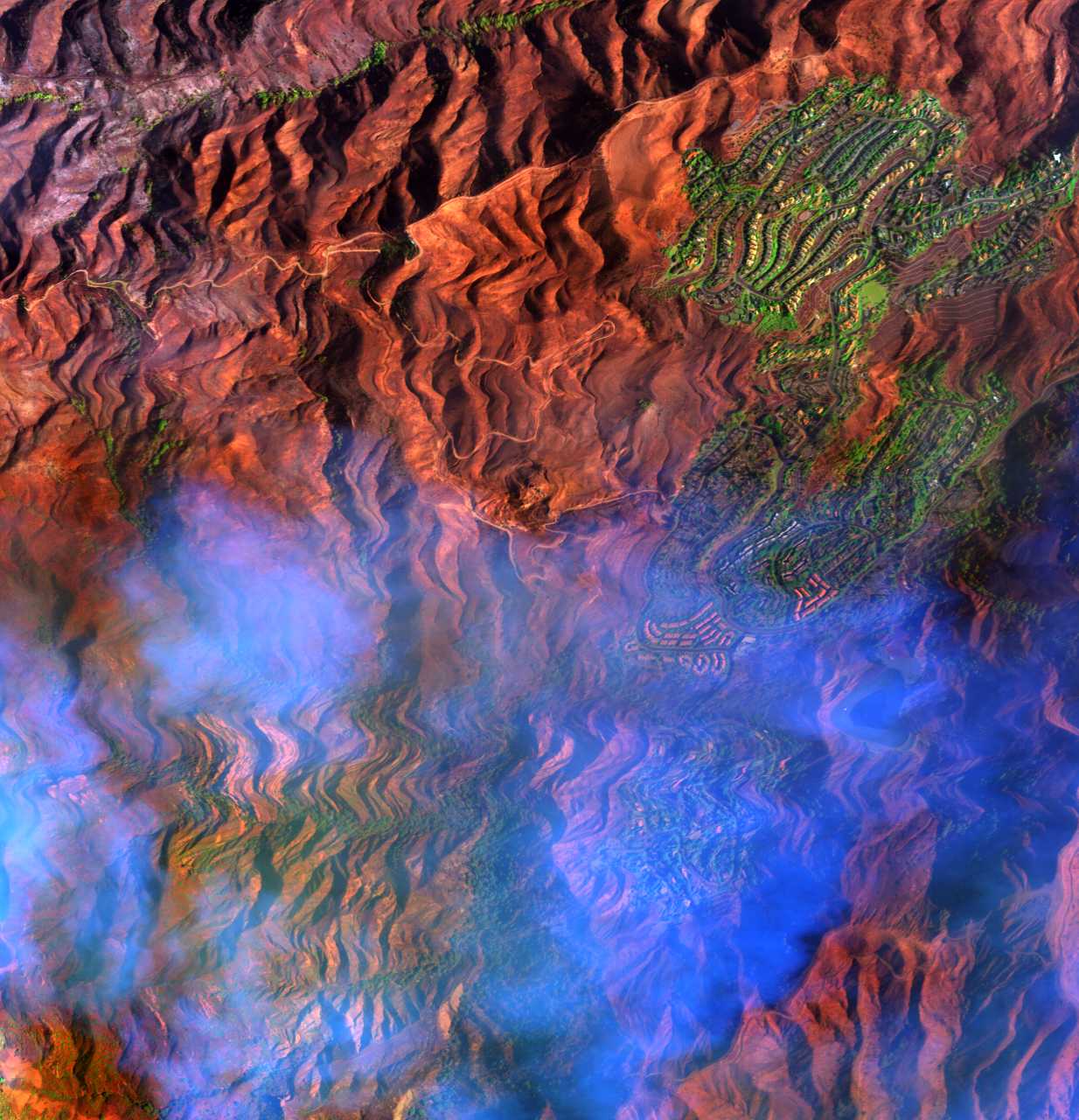
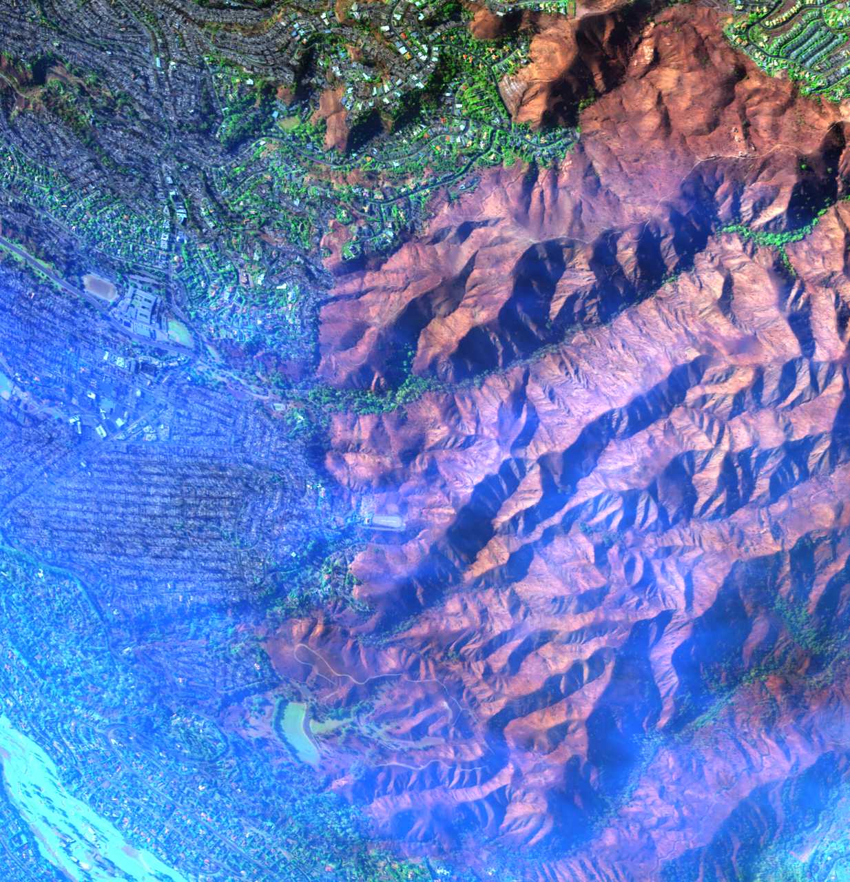
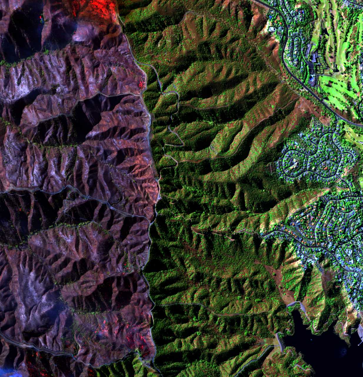
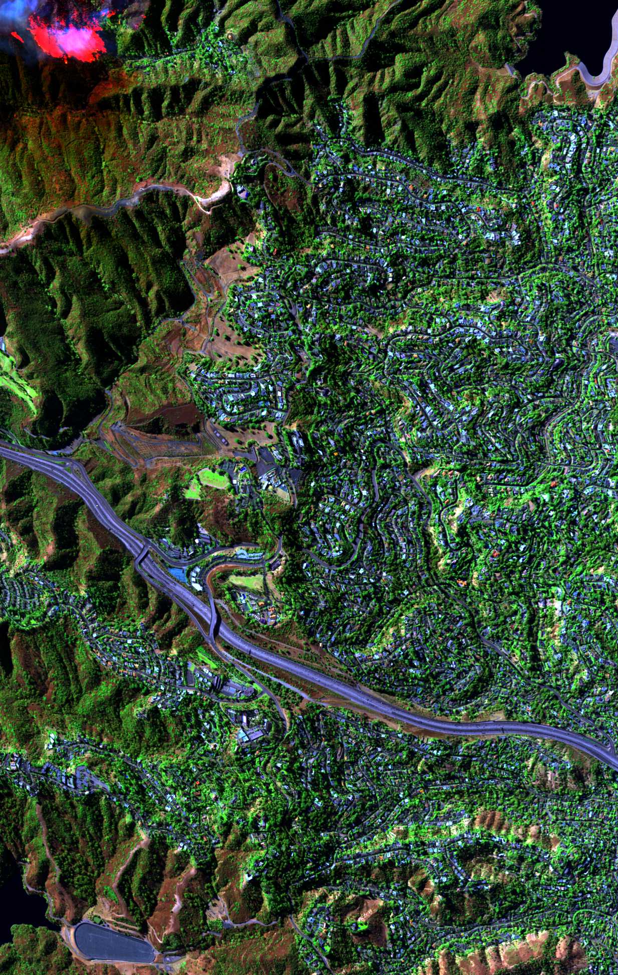
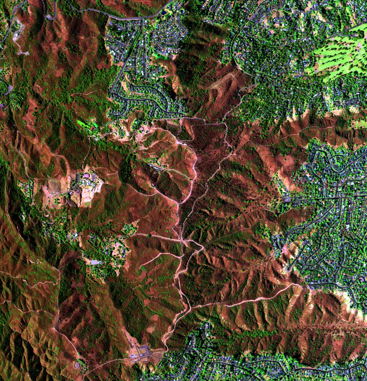
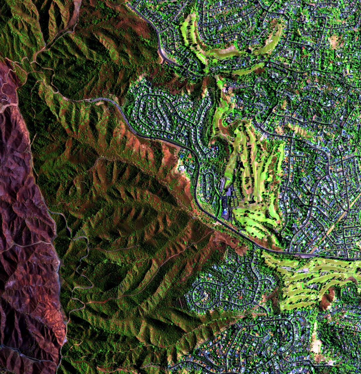
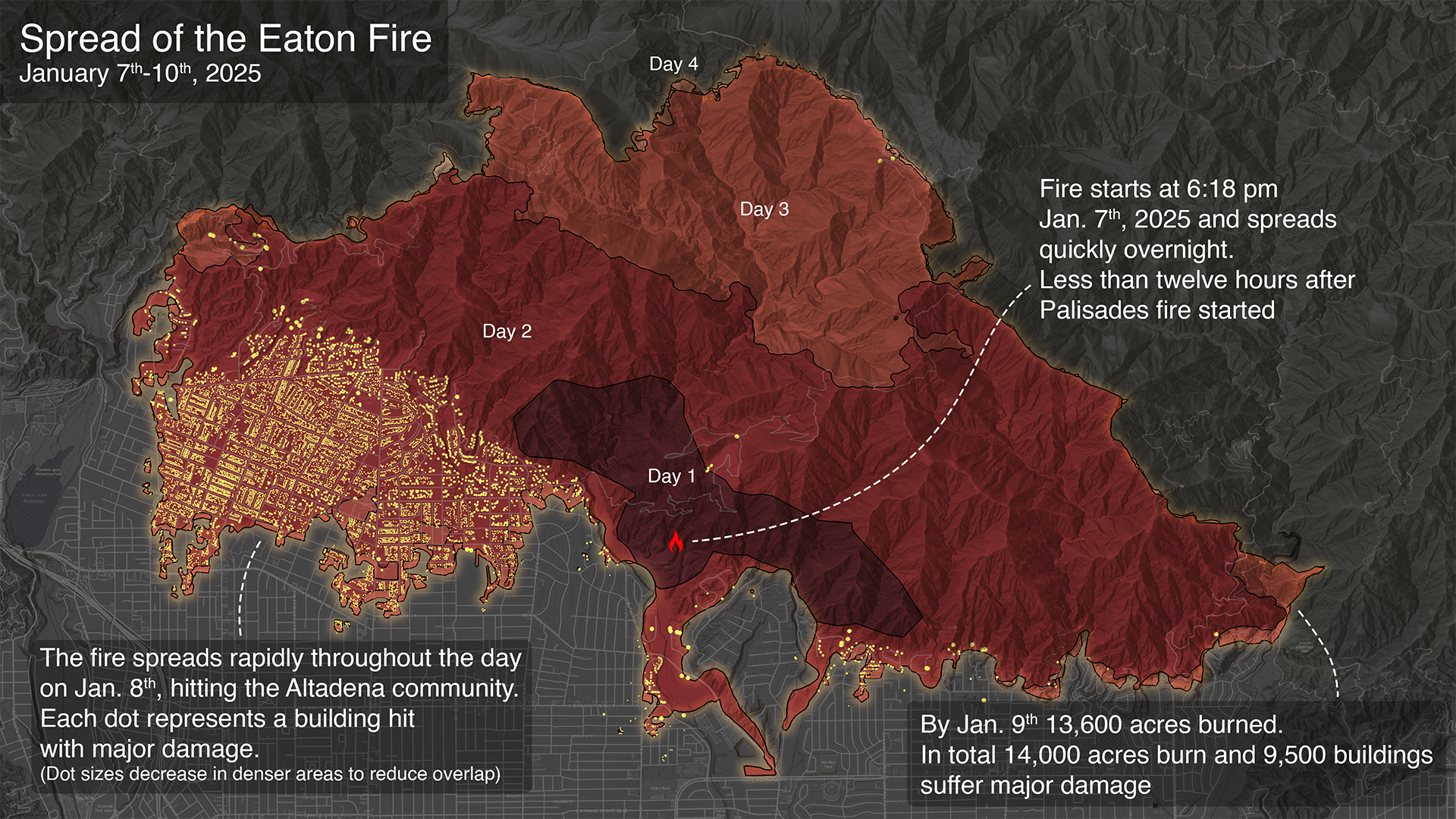
EatonCanyon
the mushy part is the burned property MAP @emit-sds @blackgirlscode

#EatonCanyonFire @CityOfLosAngeles
Supervisor Holly J. Mitchell archive.org/…/AV320250110t224555_002_L1B_RDN … Taken from #AViRiS DataPortAl / EarthDataSearch @PodaaC @NASA-GiSS @Nasa-JPL @Whitehouse
Due to wildfire evacuations, the Lab is closed, except for emergency personnel. No fire damage has been reported. Follow updates at https://t.co/yscOR5I3ys
— NASA JPL (@NASAJPL) January 8, 2025
Thanks to everyone for the concern for our center, but more importantly, for our colleagues and neighbors. Stay safe, LA. pic.twitter.com/Wjn02jlSyA


@TheSpaceDevs @BlueOrigin @NASA-PDS – @STATEOFCALiFORNiA @CiTYOFLOSANGELES @BLACKGiRLSCODE
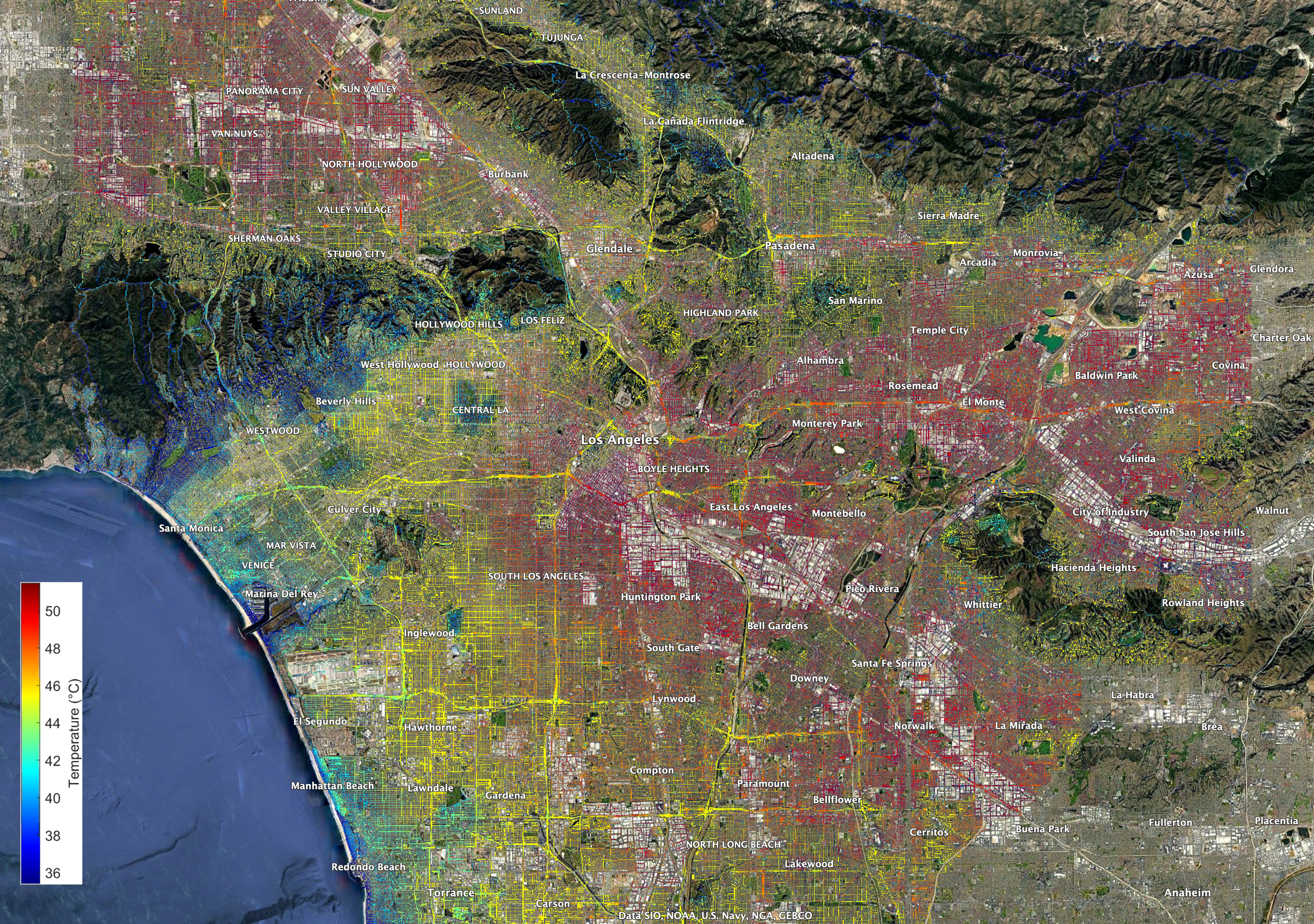
EcoStress HeatMAp
DOWNLOAD_PDF:lacounty.gov/phn/docs/Emergency%20Preparedness%20Handouts.pdf KMZ @google @stateofcalifornia GoogleMaps @nasa-jpl @blackgirlscode
Eaton Fire aerial footage around Altadena
Watch on YOUTUBE ClickHere @emit-sds @theSpaceDevs @blackgirlscode 130,527 views Jan 8, 2025 The Eaton Fire burning north of Pasadena has burned about 1.6 square miles. Aerials around La Canada, Flintridge, and Altadena. Video from KABC, Jan. 8, 2025. @StateOfCalifornia @NOAA-OWP @blackgirlscode Read more: https://www.abc10.com/article/news/lo…

DOWNLOAD_PDF:lacounty.gov/phn/docs/Emergency%20Preparedness%20Handouts.pdf
| Mapping surface water using Earth Engine (Floods, Water change, Seasonal Reservoirs) | Geo4Good ‘23 Surface water mapping using AI/ML Approaches of HYDRAFloods |
Deployment of SWOT’s Solar Arrays : WATCH READ
launched Dec. 16, 2022, at 3:46 a.m. PST from Vandenberg Space Force Base in California, and the arrays started their deployment at 5:01 a.m. PST.
#EatonCanyonFire @CityOfLosAngeles
@StateOfCalifornia KARENBASS @Cityoflosangeles @emit-sds I found a directory with what looks to be a vegitation index starting in 1981, los angeles has lost a lot of its luster and needs tlc! EarthDAta_LP_DAAC_ Index of VIP01.004: ::1981::: 1997 ;;; 2014 ……….
ALBEDO+NiGHTLiGHTS @blackgirlscode
SmolderingHills @blackgirlscode I need to show the damage in Eaton from stream @nasa-jpl
Land disturbance + Aerosol map
@stateofcalifornia Did Lack of Cityhood hurt Altadena ? @latimes @datadesk @whitehouse

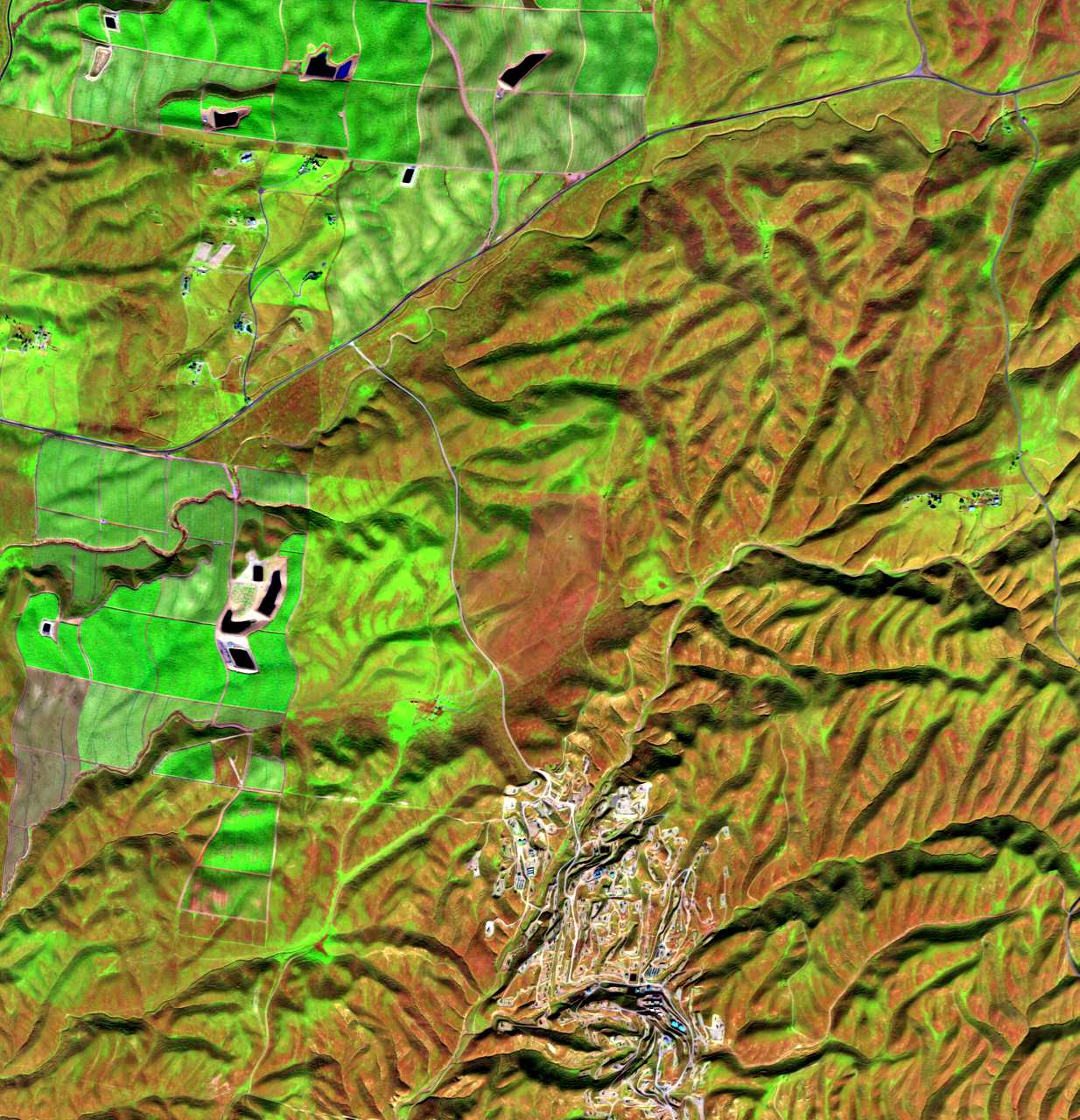
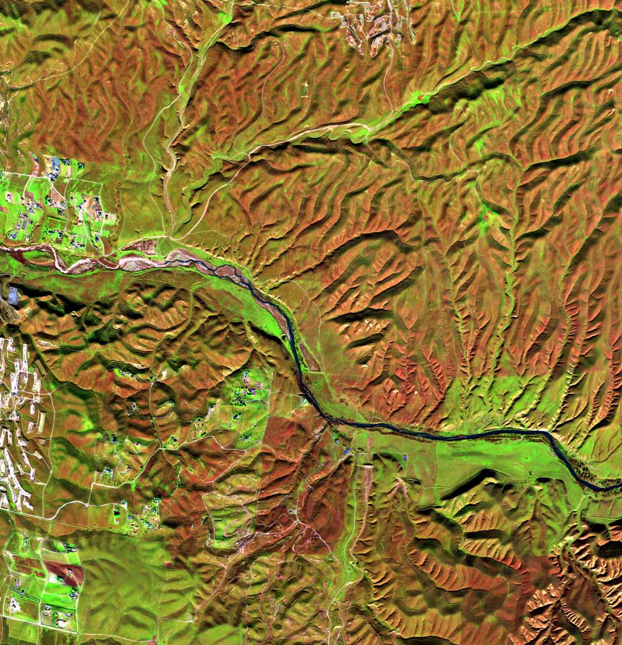
Ecostress gallery
@stateofcalifornia Did Lack of Cityhood hurt Altadena ? @latimes @datadesk @whitehouse
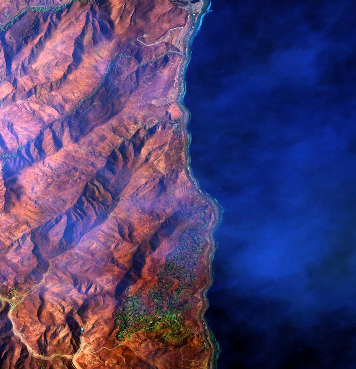
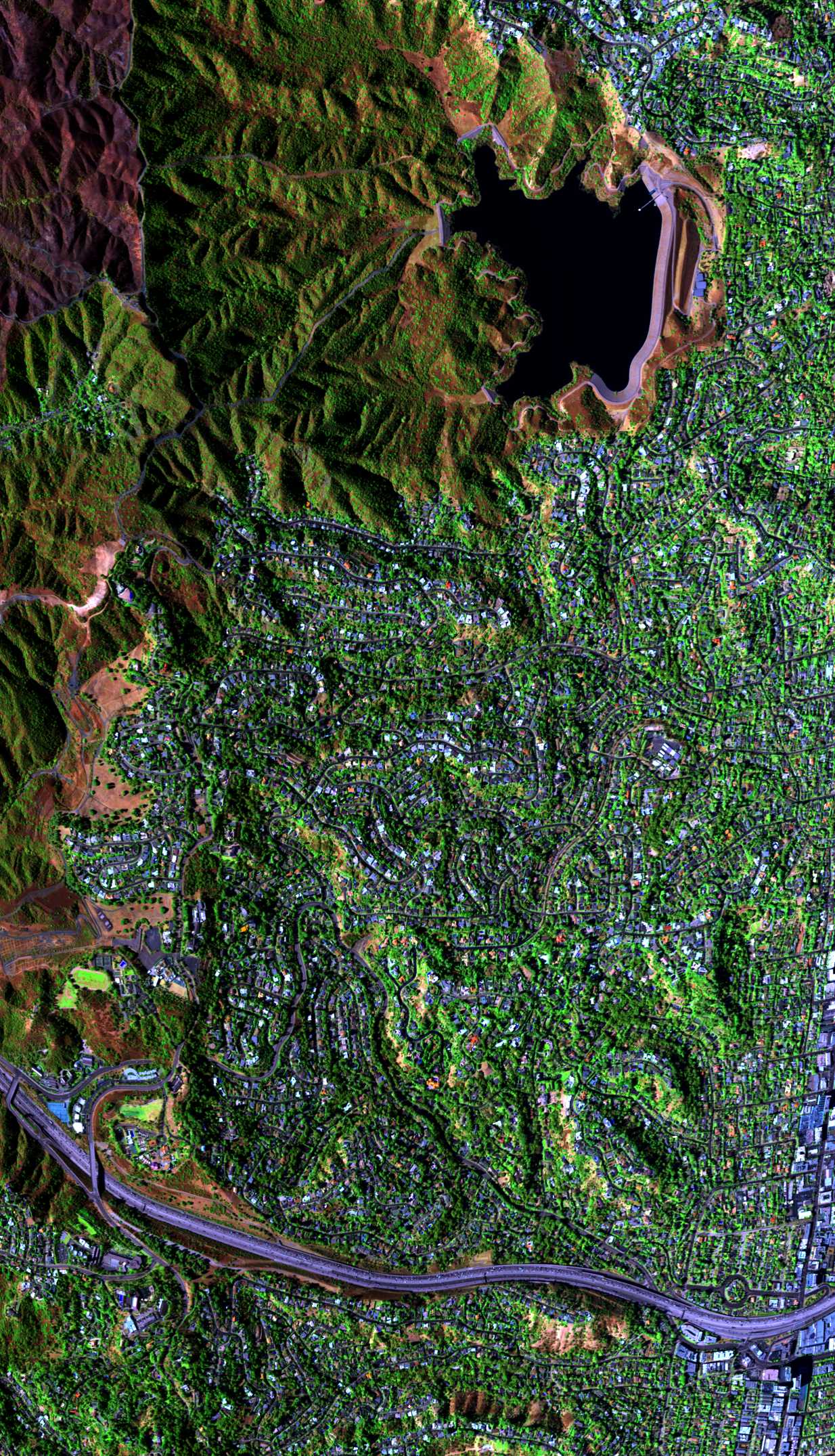
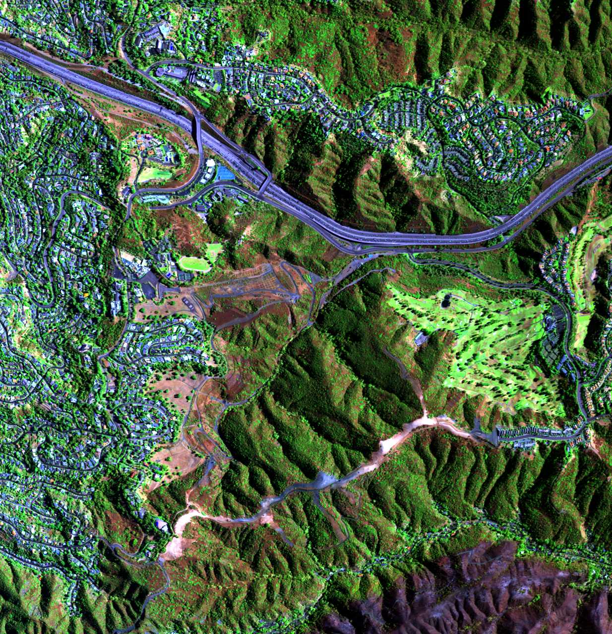
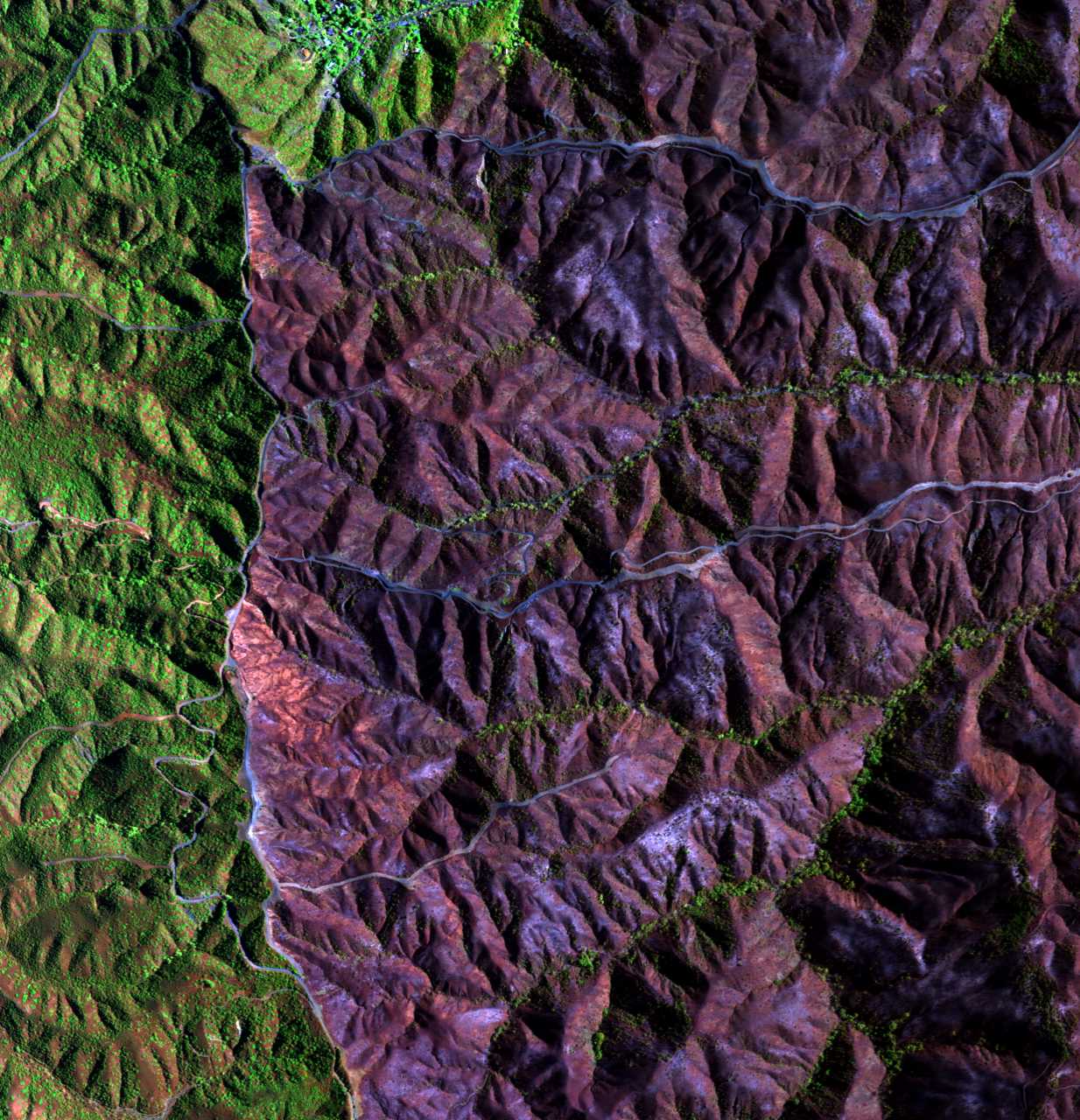
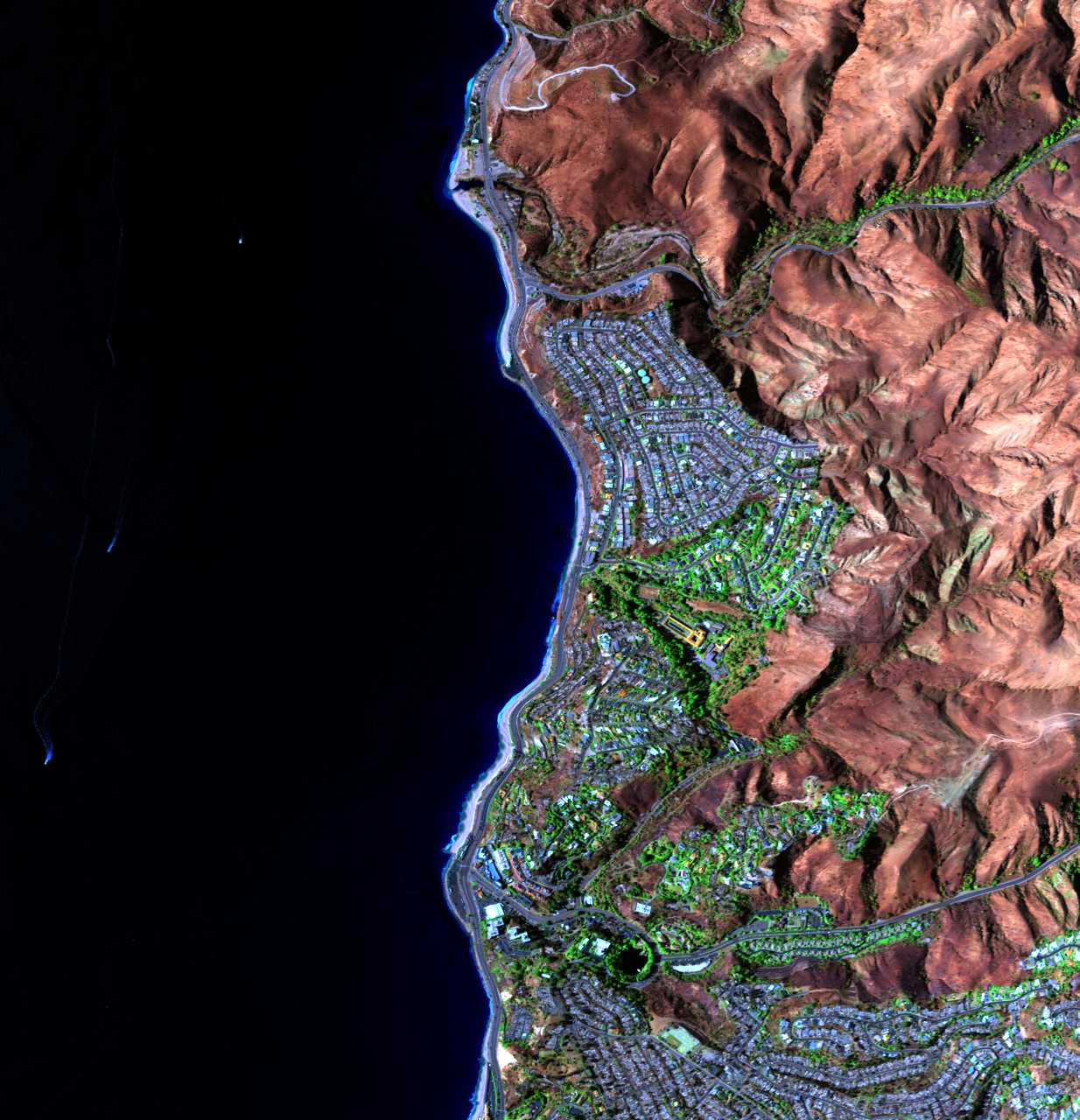
About One-third of Malibu Burned In The Palisades Fire. Where Does It Go From Here?
@nasa-jpl Latimes @datadesk made a doc @nasa its great firedata!
@datadesk related firedata @nasa-jpl @nasa-pds @nasa .pdf summerofresistance @cityoflosangeles


cartography
https://www.jpl.nasa.gov/missions/airborne-visible-infrared-imaging-spectrometer-aviris/ AVIRIS is the first full spectral range imaging spectrometer and dedicated to Earth Remote Measurements . . AVIRIS Flight Request Information - CLiCKHERE
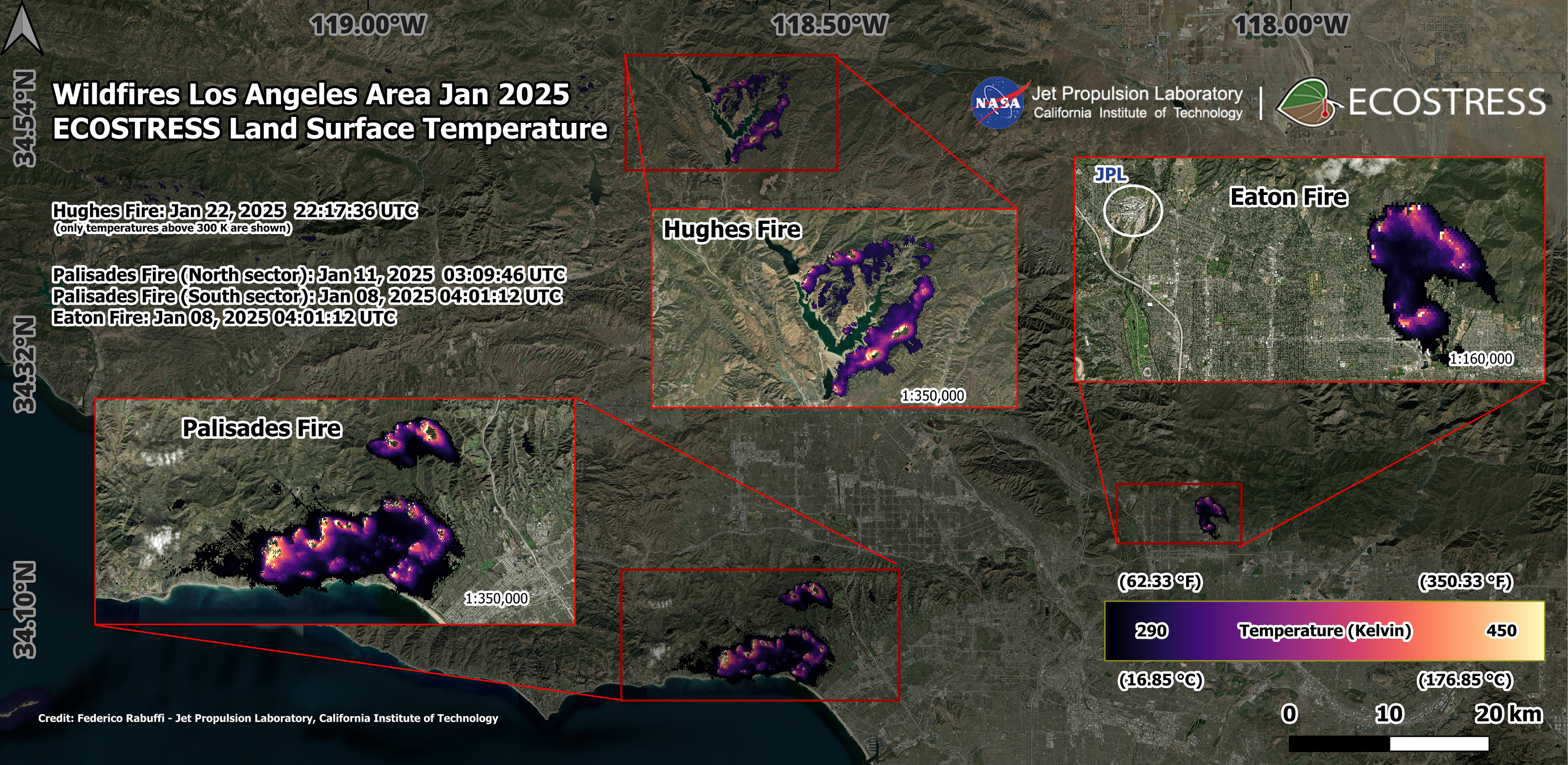
Overview Maps of 2025 Los Angeles Fires
![]() NASA’s Jet Propulsion Laboratory manages the EcoStress mission for the Earth Science Division in the Science MissionDirectorate at NASA Headquarters in Washington
NASA’s Jet Propulsion Laboratory manages the EcoStress mission for the Earth Science Division in the Science MissionDirectorate at NASA Headquarters in Washington
 @nasa-pds @nasa-jpl @nasa @whitehouse
JPL Fire Victim interview
@nasa-pds @nasa-jpl @nasa @whitehouse
JPL Fire Victim interview

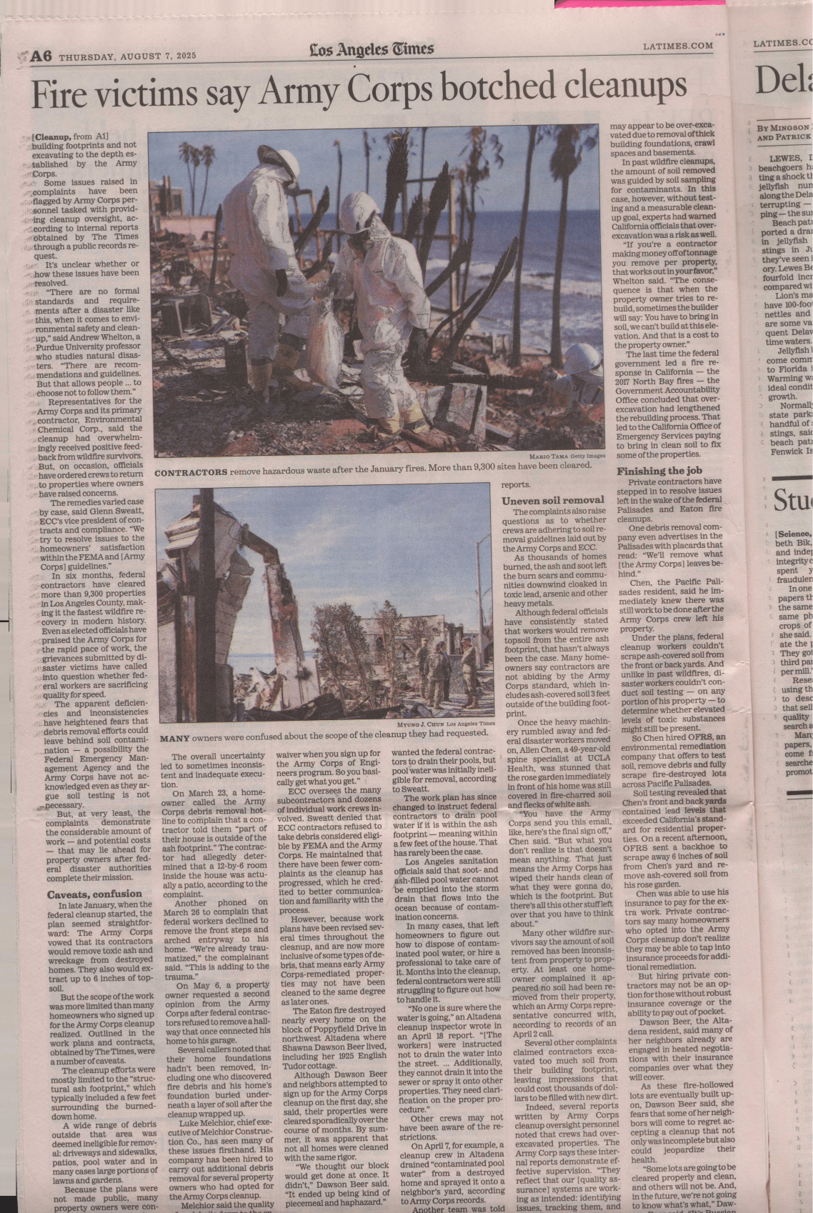
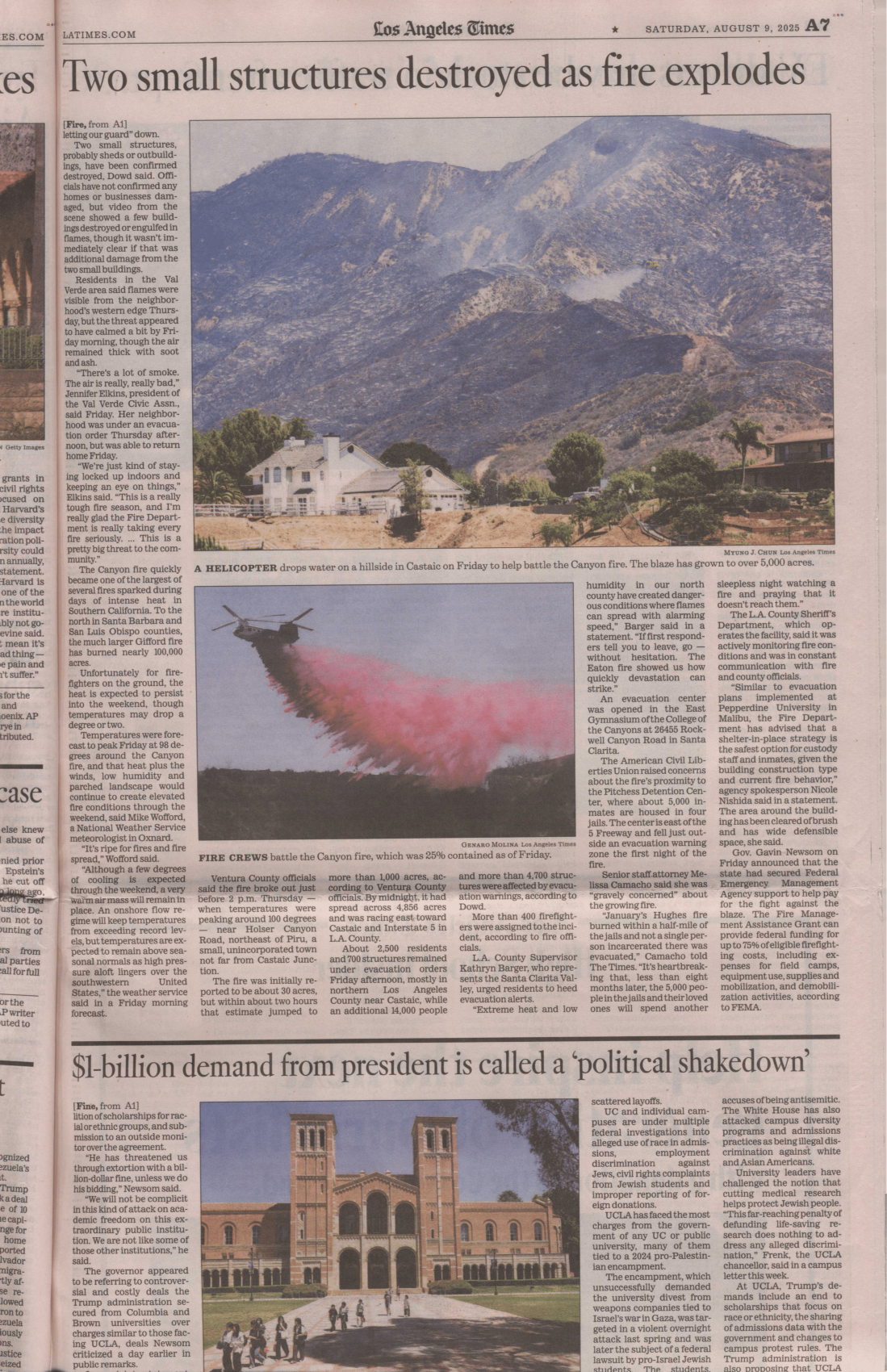
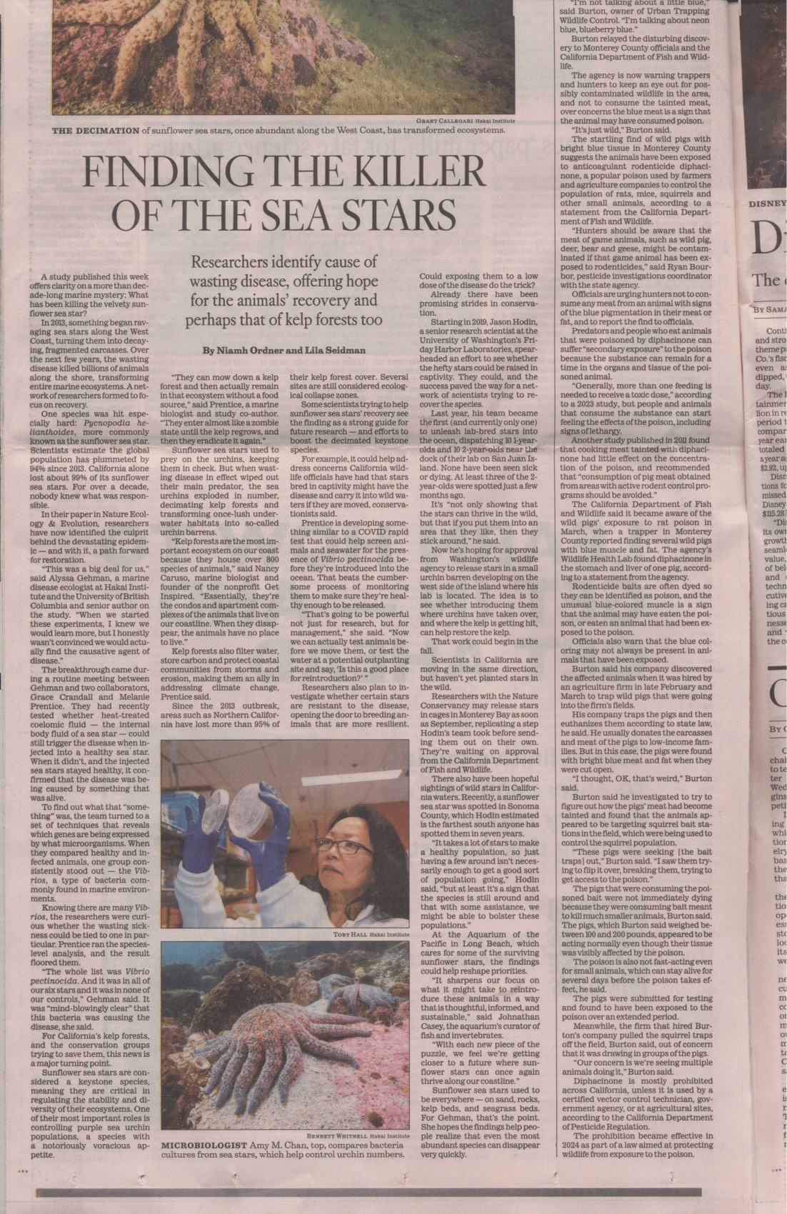
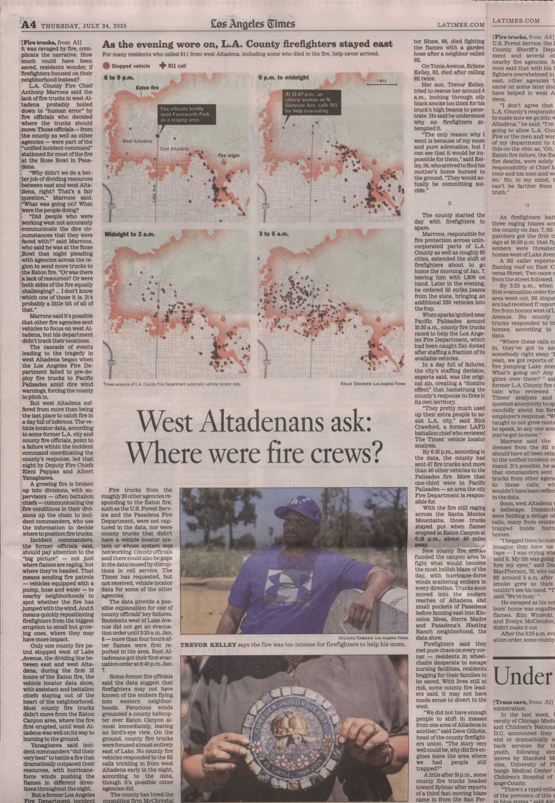
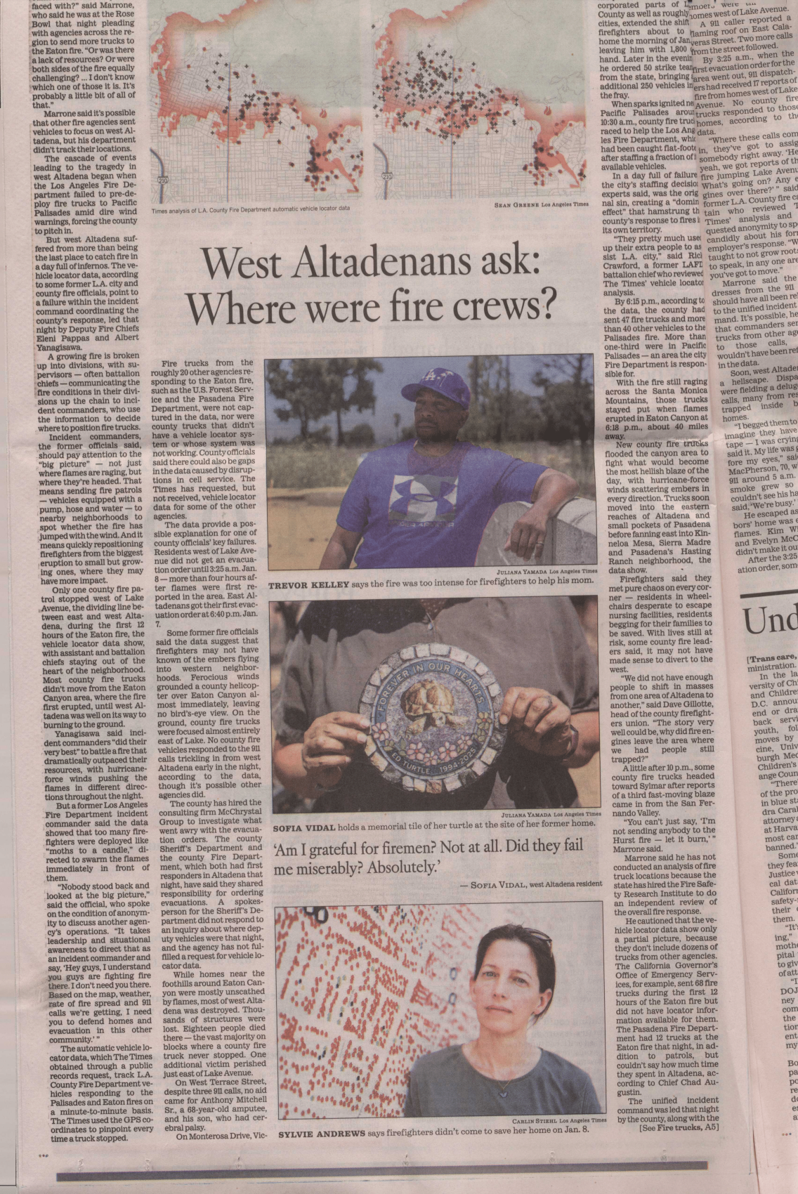
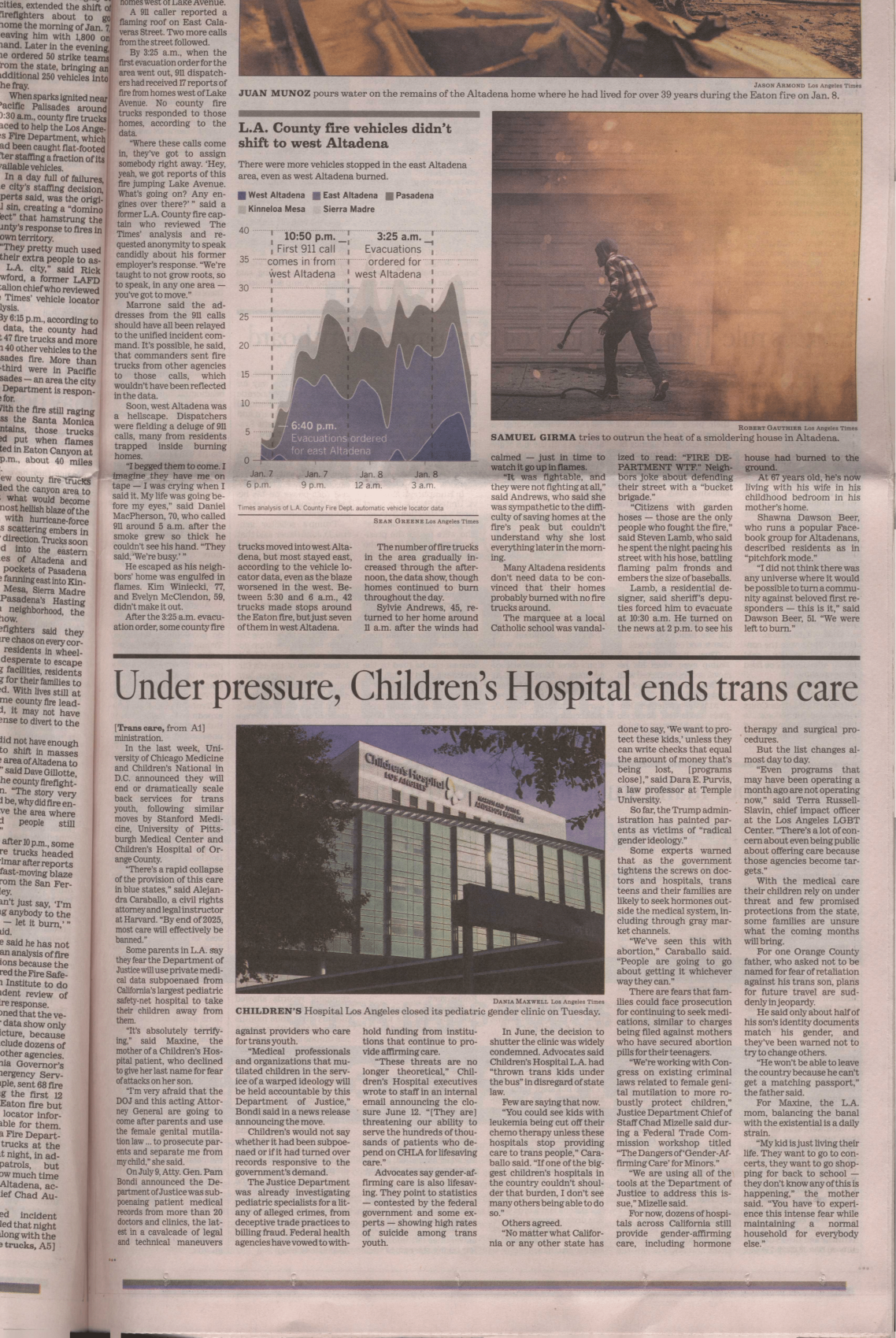
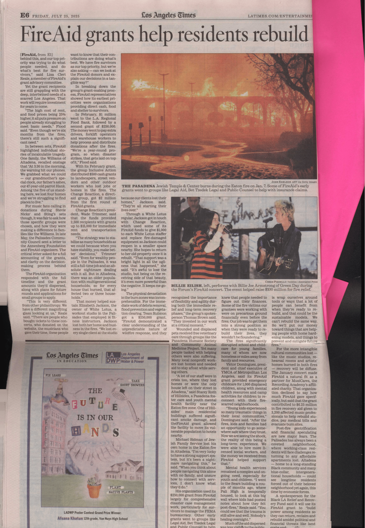
On January 7th, 2025, a series of wildfires started in the Southern California area, heavily affecting Los Angeles communities. The fires spread rapidly due to an abnormally dry year coupled with extreme winds raging at up to 100 miles per hour. Two of the fires, Eaton and Palisades, affected densely populated neighborhoods, spreading rapidly from structure to structure and combining to cause severe damage to over 16,000 homes and businesses. Released Friday, July 11, 2025
.jpg)

Fires Tear Through Los Angeles Powerful Santa Ana winds and dry conditions contributed to the rapid spread of several brush fires in the county. ReadMoreSeemORe
Palisades Fire reaches Brentwood, threatens San Fernando Valley @ktla youtube.com
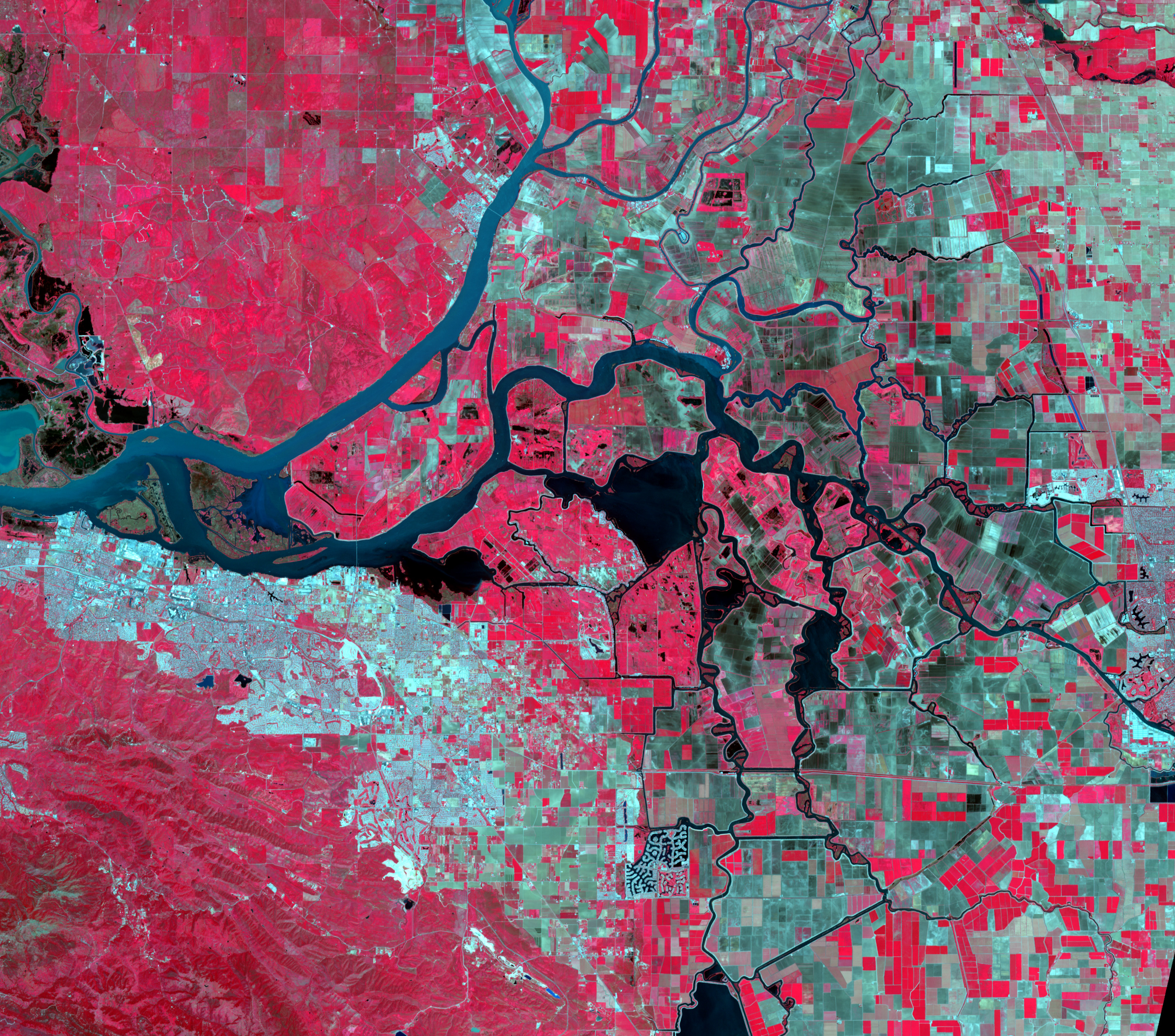
GRACE and GRACE-FO track California’s land water changes
NASA’s Gravity Recovery and Climate Experiment (GRACE, 2002 - 2017) mission, and its successor GRACE Follow-On (launched in 2018), map month-to-month changes in Earth’s gravity field resulting from the movement of mass, such as water, near the surface of the planet. This animation shows how the total amount of water (snow, surface water, soil moisture, and groundwater) varies in space and time, with the passage of dry seasons and wet seasons as well as with flooding, drought, and transport due to water management. Blue colors represent wetter than average conditions (relative to 2004-2010), while red colors represent drier than average conditions. The yellow line in the graph on the left shows the evolution of the long-term inter-annual variations for the area outlined in yellow on the map (note: the average seasonal cycle has been removed).
The Sacramento and San Joaquin River basins are outlined in yellow, and rivers and tributaries are shown as blue lines. The basins include California’s Central Valley, the most productive agricultural region in the U.S. Repeated drought conditions and increased water use in California have led to a long-term decline of terrestrial water, interspersed with above-average precipitation periods (e.g., 2015/2016, 2022/2023) that have allowed some recovery of the land water storage.
Credit NASA / JPL
A view of the #EatonFire behind @NASAJPL Flight Projects Center. It feels like Armageddon around here pic.twitter.com/pPWJ0B2rIB
— Royce (@RobRoyce_) January 9, 2025
What’s in the Soil? WATCHNOW
@datadesk we do a lot of environmental scanning, but we running from poachers man! help us out @FEMA latimes said you are not testing, but i dont think they doing nothing but being hustled… @podaac @nasa-jpl @abc7 @cbsnews @datadesk @washingtonpost
Guests: Tony Briscoe, LA Times Environment Reporter Noah Haggerty, LA Times Science and Environment Reporter Megan Lorick, Malibu Resident Malibu residents demand city leadership for rebuilding after devastating fires
@cbs-news-data @nasa-jpl @blackgirlscode @whitehouse
@noaa VJ102DNB - VIIRS/JPSS1 Day/Night Band Moderate Resolution 6-Min L1B Swath 750m imported to @googleearth via NasaWorldView_KeyholeMarkeup ~_KMZ_EXPORT @blackgirlscode
1 # HOLE_TO_ANOTHER_UNiVERSE#####@NASA-JPL######hiCORAL###
2 # ### How Wildfire Looked Across @CityOfLosAngeles #####
3 # @StateOfCalifornia #`BrandyNorwood @BlackGirlsCode `##About One-third of Malibu Burned In The Palisades Fire. Where Does It Go From Here?
@nasa-jpl Latimes @datadesk made a doc @nasa its great firedata!
@datadesk related firedata @nasa-jpl @nasa-pds @nasa .pdf summerofresistance @cityoflosangeles
2 # ### How Wildfire looks across the continent ##############
3 # ANOTHER########`BrandyNorwood @BlackGirlsCode `Production#
+ @cityoflosangeles DEC 23-to-2025 JAN 14 FireActiity @stateofcalifornia .gif DOWNLOAD @nasa-jpl @emit-sds @TheSpaceDevs @BlueOrigin @r-spacex @NOAAgov
SmolderingHills @blackgirlscode I need to show the damage in Eaton from stream @nasa-jpl
layout: default title: HoleToAnotherUniVersE